Dear residents of the Pacific Northwest,
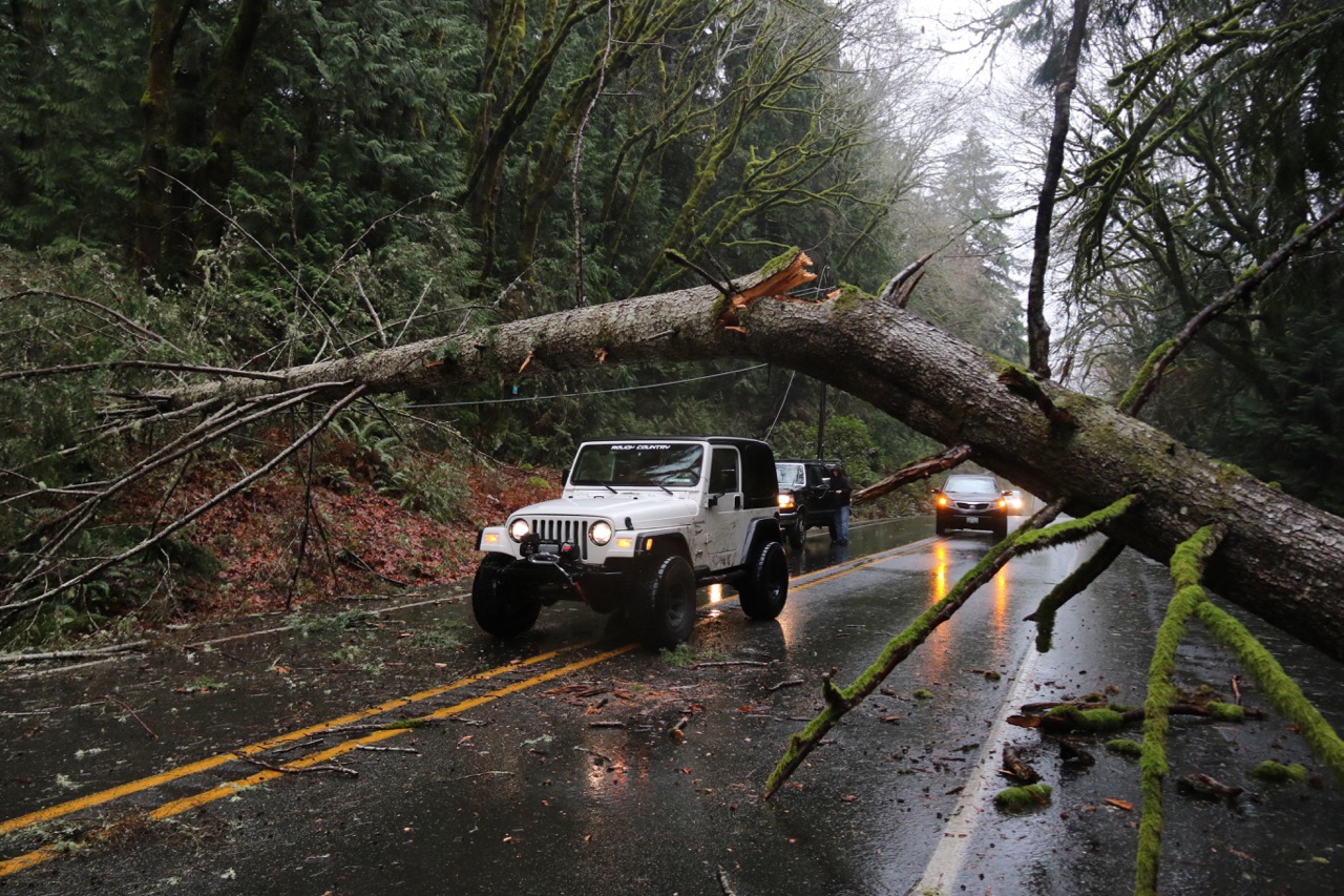
The following weekend is going to be wet, windy an wild. You might lose power, you might see intense flooding, you might have trees come crashing down around your neighborhood. We might see numerous access roads to National Forest lands and National Parks washed out. We might experience the worst storm in 50 years and all hell could possible break loose. We ask you be prepared and know the weather. This is not the weekend to prove you are invincible. Be safe and smart and don’t take any unnecessary risks. While the South Sound and southern stretches of the Olympic Peninsula may be spared from the worst, we will still see some pretty rough weather.
Starting on Thursday, October 13th, Western Washington is expected to see one of the worst wind and rain storms since the famous Columbus Day storm of 1962. As the remnants of Pacific Typhoons head right at us, the entire region is preparing for the potentially violent weather. Flooding on rivers is expected, especially the Skokomish, while fallen branches, trees and mudslides could plague the region. Of course, it could just be a few windy and wet days too, but I wouldn’t hold your breath for this system to miss us. Remember that this is actually a few storms barreling down on us. Thursday afternoon and evening will be rough, then Friday will be more calm before the next wave of potentially destructive weather slams into the region on Saturday. Saturday could be one of the worst storms in 54 years, even predicted as such by weatherman extraordinaire, Cliff Mass. While he says the main storm actually will miss hitting us directly (sorry Canada), the sections we receive will be intense and could be unlike anything we have seen for quite awhile.

The Rain
In the high elevations and remote regions of Olympic National Park, over a foot of rain is expected to fall in just 90 hours. Forks, Washington will easy get over half a foot of rain, while the “dry” city of Port Angeles will receive over 4 inches. To put that in perspective, the city of Port Angeles has an annual rainfall of 25 inches, giving 1/6 of the yearly rain in just four days. This storm is also expected to dump over 8 inches of rain along Hood Canal, with more in the higher elevations. This rain will lead to serious flooding on the South Fork of the Skokomish and possible washouts and mudslides throughout the Olympic Peninsula. If you don’t have to go outside, I wouldn’t. Hikers need to be aware that creeks and small streams will turn into raging torrents of water and may be impassible. We also highly advise against anyone going up into the mountains. We could go on and on about the rainfall, but it is probably easier to just let you look at the map and see for yourself.


The Wind
From Thursday evening through late Thursday night, the National Weather Service in Seattle is issuing a high wind watch. Starting early Thursday evening, strong winds are expected to start, reaching their peak speeds around midnight. The winds on Thursday night will be coming from the south to southeast, hitting around 25 to 40 mph along the Washington coast and in the north interior of western Washington. Gusts are expected to be around 60 mph in that region, while the winds in the Puget Sound region and southwest interior could reach 20 to 35 mph with gusts 45 to 55 mph. Along the northern Olympic Peninsula and up in the mountains, gusts and sustained winds may be much higher on Thursday Night and Friday morning. Friday is expected to be a bit calmer around the region, but don’t expect that to last long. By Saturday, sustained winds along the northern Olympics could be over 60 miles per hour, with gusts possibly hitting 80 miles per hour. While that is the extreme, be aware that these winds, mixed with the heavy rains, can cause serious damage. Luckily, the center of this storm is headed toward Vancouver Island (sorry again Canada), sparing us from the intensity. According to Cliff Mass, the strongest winds will not be experienced by residents of the Puget Sound, but the storm’s large size and strength will bring 30-50 mph gusts around Puget Sound. The strongest winds appear to be hitting Saturday afternoon and evening. There is still a possibility that the storm will shift course, slamming into the Puget Sound and Olympic Peninsula at a level few have experienced. Please continue to check your local forecast and be prepared to lose power. Also, know that trees will be down on Highway 101, which could take hours to remove and make the road passable.

The Waves
Out along the coast, where the winds are expected to be the strongest, another factor of the storm has the potential to cause damage to the region. During the series of storms, huge waves and a storm surge will created some problems for low-lying communities. The coast is expected to see giant waves throughout the end of the week and weekend, causing coastal saltwater flooding. Right now, the National Weather Service is seeing 36 foot swells off the coast, much larger than anything we normally see. While the temptation may be to head out to the coast and ride this thing through, conditions along the beaches will be deadly, as huge waves and storm swells can easily too giant pieces of driftwood onto the shore. Bluffs may erode, so your safest course of action is just to hunker down and wait until this thing has passed. Especially on Friday- Sunday.


The Storm in Olympic National Park
Those headed to Olympic National Park this weekend are going to probably have their visits cut short due to weather. Not only is the entire region going to be a raging torrent of water, but the area is prone to fallen trees and road washouts. Last year, a similar storm that was packing high winds, rain and flooding restricted access to the Elwha, Quinault, Sol Duc, Hurricane Ridge and Staircase and even Rialto regions, with the Elwha and Quinault sustaining enough damage to be closed the entire summer of 2016. As of noon on Wednesday, October 12th, 2016, no closures have been announced for Olympic National Park. However, this may change at any minute, which we will update. If you are heading out to the Olympic Peninsula and Olympic National Park this weekend, be aware of the weather and expect to have limited options of destinations to visit. The weather is going to be wet and windy, so be smart, be prepared and take only acceptable risks.
Up in the Olympic Mountains of the park, Mount Olympus is going to receive a blast of cold and nasty weather. In the next four days, the tallest peak in the Olympics will see 90 inches of snow, with 26 inches coming Friday night. That is a total of over seven feet of snow in just a few short days. With winds in the upper 70s, this is not a time to be climbing. Elsewhere in the Olympic Mountains, the snow level will be dropping down to 5,500ft by Sunday, meaning that the majority of the popular peaks in the Olympics will see a chance of significant snowfall.
Buckle up, everyone. This could be intense.


