The last week of fall is here, meaning that true winter is just around the corner. For most of the Olympic Peninsula, winter has been in full force for the better part of December. After a wet and wild fall, cold air is sitting on our region, giving our mountains a well-deserved blanket of snow. While the past seven days have been snowy in places, the majority of the snowpack around the Olympic Mountains has seen small, incremental growth. No major storms rolled in, but the current snowpack is still a whopping 170% of normal for this time of year. This is awesome!
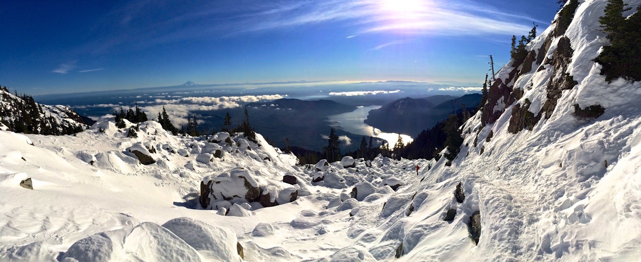
As of December 16th, 2016, snow is blanketing the entire Olympic Peninsula. Snow is on nearly every low elevation trail and the mountains are thick with feet of powder piling up after numerous storms dumped on the region. This winter seems to finally be back on track after a few years of less than stellar snow. The mountains are getting slammed by each and every storm that rolls through, making the mountains somewhat unsafe for exploration and adventures. However, popular ares in the winter are still accessible and even the lowland trails have been transformed into winter wonderlands. If you can, head out into any of your favorite river valleys or peaks in the Olympics and enjoy the splendor of an above average snowpack!

If you plan on visiting the Olympics, make sure to check road and trail conditions before heading out. These can be found on our Adventure Dispatch (updates Late Friday/Early Saturday) and on the Olympic National Park website. All information about snowpack was found at the USDA website, looking at the four monitoring stations around the Olympic Peninsula. This post should only serve as educational information and is in no way the only source you should be trusting.

HOW IS THE OLYMPIC MOUNTAIN SNOWPACK THIS WEEK?
Mount Olympus
While no snowpack information is available on the remote and stunning Mount Olympus in the heart of the Olympics, the week’s weather forecast will show you just how unstable and rough it will be in the higher peaks of the Pacific Northwest this coming week. This week, Mount Olympus, which is nearly 8,000 feet above sea level, will see rough weather with tons of snow, wind and cold. Between Friday and Tuesday, Mount Olympus will see 70 inches of snow, wind speeds up to 60 miles per hour and a windchill of -11 degrees Fahrenheit. Anyone up for a summit attempt?
DUNGENESS
In the last week, there has been no significant change in the snowpack at this monitoring station. The monitoring station for the Dungeness area is 4,010 feet above sea level and currently has a total snowpack of 17 inches, losing an inch from last week. This is due to the area’s location along the drier side of the Olympic Mountains, receiving far less precipitation than elsewhere in the region. That being said, the area is seven inches above the average snowpack for this date. The average snowpack, for Dec. 16th over the past 15 years, at this location is 10.7 inches.
Snowpack for today’s date at this station of the last 15 years:
2001: 20 inches
2002: 14 inches
2003: 5 inches
2004: 1 inches
2005: 5 inches
2006: N/A
2007: N/A
2008: 9 inches
2009: 9 inches
2010: 12 inches
2011: 6 inches
2012: 18 inches
2013: 2 inches
2014: 0 inches
2015: 21 inch
2016: 17 inches
WATERHOLE
Located just below Hurricane Ridge, the Waterhole station In the last week received 12 inches of new snow, with six of those inches of melt off or compacting down. At 5,010 feet, the are now has a total of 51 inches of snowpack, up from 45 last week.Higher up at the Hurricane Ridge Visitor Center, they are said to have 55 inches of snow, but this has not been officially confirmed. All of this snow does mean that the region is open for skiers and snowboards to experience Hurricane Ridge this winter. Remember that access to Hurricane Ridge is limited in the winter, so please follow this link to see how you can visit this wintery wonderland. The historical snowpack for today’s date has an average of 32.6 inches over the past 15 years, placing the area well above average for recent winter days.
Snowpack for today’s date at this station of the last 15 years:
2001: 50 inches
2002: 6 inches
2003: 41 inches
2004: 22 inches
2005: 29 inches
2006: 51 inches
2007: 22 inches
2008: 3 inch
2009: 46 inches
2010: 40 inches
2011: 22 inches
2012: 69 inches
2013: 18 inches
2014: 0 inches
2015: 19 inches
2016: 51 inches
MOUNT CRAG
Located just north of the Dosewallips River and sits at 4,314 feet above sea level, the Mount Crag station had a good week of snowing, seeing 9 inches of snow and increasing the snowpack by 7 inches after melt off. The total snowpack for the region is 43 inches, up from 36 last week. The Mount Crag station has received 10 inches more snow than the 15 year average on today’s date, helping demonstrate why this is a much healthier snow year for the Olympic Mountains.
Snowpack for today’s date at this station of the last 15 years:
2001: 56 inches
2002: 30 inches
2003: 32 inches
2004: 13 inches
2005: 22 inches
2006: 68 inches
2007: 25 inches
2008: 11 inch
2009: 47 inches
2010: 31 inches
2011: 22 inches
2012: 51 inches
2013: 3 inches
2014: 0 inches
2015: 48 inches
2016: 43 inches
BUCKINGHORSE
Finally, we end at the Buckinghorse station, located 5km NW of the Enchanted Valley in the Quinault region of Olympic National Park. Sitting at 4,870 feet above sea level, the station currently has 72 inches of snow sitting on the majestic peaks of the area. Last week, 19 inches of snow fell at this monitoring station, but nine of those inches melted and compacted down, giving the area a gain of 10 inches for the week. Looking at recent historical snowfall data, the Buckinghorse region is 26 inches above normal for snowpack on today’s date. The average snowpack for Dec. 16th over the past 9 years is 46.4 inches.
Snowpack for today’s date at this station of the last 9 years:
2008: 13 inches
2009: 79 inches
2010: 66 inches
2011: 31 inches
2012: 83 inches
2013: 7 inches
2014: 5 inches
2015: 62 inches
2016: 72 inches
WANT AWESOME TRIPS IN AND AROUND OLYMPIC NATIONAL PARK?
ORDER YOUR COPY OF: 52 HIKES OLYMPIC PENINSULA