Snow has fallen all around the lowlands of the Pacific Northwest, so you know what time it is!
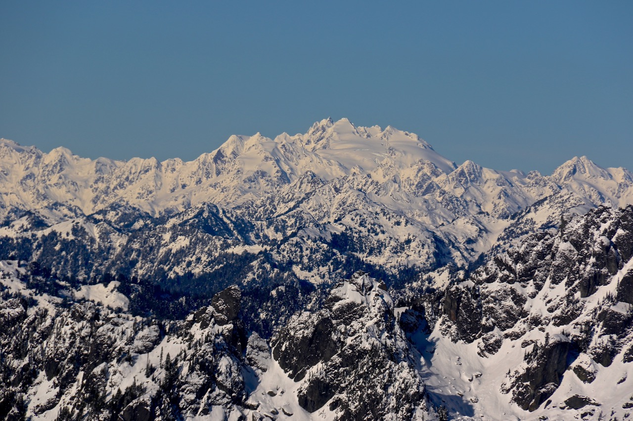
Welcome to the first of many snowpack updates for the Olympic Mountains for the winter of 2016-17. As I am writing this, I am watching the four inches of snow we received last night in Olympia melt away while looking at forecasts for more snow in the Olympic Mountains. So far, this winter has been great for building up our snowpack and the trend of snow in the mountains without serious melt-off looks to continue. Did you see the Olympics, covered in snow, from space?
Right now, the snowpack in the Olympic Mountains is looking amazing, showing an above average snowpack after a few years of lackadaisical snowfall. While the salmon and the health of the rivers and glaciers rejoice, numerous outdoor enthusiasts are a bit bummed out right now. Snow in the Olympics is a double edged sword; while the snowpack ensures strong water supplies through the summer, it also means that outdoor recreation in the higher elevations is restricted in accessibility. With such a low snow event happening this week and possibly happening again in the coming week, finding snow free trails will be next to impossible in most regions. Welcome to winter!
As of December 9th, 2016, snow is all over the Olympic Peninsula. While I could try and get snow totals for every low-elevation trailhead, I am keeping this post strictly about the mountains of Olympic National Park and Forest. Road and trail conditions can be found on our Adventure Dispatch (updates Fridays, starting Dec 16th) and the Olympic National Park website. All information about snowpack was found at the USDA website and looking at the four monitoring stations around the Olympic Peninsula. This post should only serve as educational information and is in no way the only source you should be trusting.
Before we dive into the data, I want to share the weekend forecast for Mount Olympus in Olympic National Park. The high at Mount Olympus, which is nearly 8,000 feet above sea level for the weekend is going to be 16 degrees, with a low of just nine degrees. Thanks to a wind that will be between 20 and 30 miles per hour, the wind chill will be dropping to negative nine degrees for most of the day. The expected snowfall through Monday night is a jaw-dropping 60.7 inches in 96 hours. For those asking how the weather in the Cascade mountains will be, Olympus is a decent indicator of what you will be facing. Any tall peak in the Pacific Northwest is going to be brutally cold and get dumped on this weekend, so stay safe and make smart choices.

HOW IS THE OLYMPIC MOUNTAIN SNOWPACK?
Dungeness
Above the Dungeness River, America’s second steepest river, the snow depth is resting comfortable at 15 inches. Last year, the area had just one inch, so we are well ahead of that! The Dungeness is partially blocked in the rain shadow of the Olympics, so snow totals here can wildly fluctuate, depending on storms and elevation. Over the next week, expect up to one foot of snow to fall in the area, with more likely totals around five or six inches. The temperatures in the coming week are also very cold, so little to no melt off is expected. The monitoring station for the Dungeness area is 4,010 feet above sea level and the snow level is said to be hovering around 500 feet through next week.
Snowpack for today’s date at this station over the last 15 years:
2001: 23 inches
2002: 0 inches
2003: 3 inches
2004: 0 inches
2005: 5 inches
2006: N/A
2007: N/A
2008: 0 inches
2009: 6 inches
2010: 8 inches
2011: 4 inches
2012: 17 inches
2013: 3 inches
2014: 0 inches
2015: 1 inch
2016: 15 inches
Waterhole
At 5,010 feet, the monitoring station at Waterhole sits just below Hurricane Ridge in Olympic National Park and gives us a great glimpse at the region’s snowpack. Right now, the station is currently reporting that it has a snow depth of 45 inches, more than double the amount rom the same day last winter. In fact, the snow depth in this area is the second highest in a decade! On this date in 2015, the station had just 17 inches of snow and in 2014 had only one inch. Hopefully, this is a sign of good things to come. The forecast this coming week for the Hurricane Ridge region expects between 7 and 11 inches of snow through the weekend, with clearing expected for some of next week. However, access to Hurricane Ridge is limited in the winter, so please follow this link to see how you can visit this wintery wonderland.
Snowpack for today’s date at this station over the last 15 years:
2001: 48 inches
2002: 4 inches
2003: 39 inches
2004: 23 inches
2005: 27 inches
2006: 52 inches
2007: 19 inches
2008: 1 inch
2009: 43 inches
2010: 37 inches
2011: 25 inches
2012: 65 inches
2013: 15 inches
2014: 1 inch
2015: 17 inches
2016: 45 inches
Mount Crag
Mount Crag is located just north of the Dosewallips River and sits at 4,314 feet above sea level. It is also home to another snowpack monitoring station a few hundred feet below the summit. The current snowpack is 36 inches, an substantial increase compared with the the 20 inches of snow that sat here last year. The current total is the 5th highest total over the past 15 years, marking the start of what could be a long lasting snowpack for the mountains along Hood Canal. We have come a long way since the one inch and zero inches of 2013 and 2014.
Looking at the data, the smaller mountains of the Olympics along Hood Canal all can have substantial snow on them for quite awhile. According to one forecast model, Mount Ellinor could be receiving nearly 30 inches of snow by Monday, so you probably want to avoid the mountains along Hood Canal until at least mid-week.
Snowpack for today’s date at this station of the last 15 years:
2001: 52 inches
2002: 1 inch
2003: 23 inches
2004: 32 inches
2005: 22 inches
2006: 47 inches
2007: 13 inches
2008: 0 inches
2009: 38 inches
2010: 26 inches
2011: 23 inches
2012: 49 inches
2013: 1 inch
2014: 0 inches
2015: 20 inches
2016: 36 inches
Buckinghorse
Finally, we end at the Buckinghorse station, located 5km NW of the Enchanted Valley in the Quinault region of Olympic National Park. Sitting at 4,870 feet above sea level, the station currently has 62 inches of snow sitting on the slopes. This is the third highest total since the snow station was set up in 2008, and neatly double the snowpack total of 2015. The region will be receiving more snow over the weekend, but estimates are all over the board. Mount Olympus, which is somewhat close but early double the elevation, is expected to get a whopping 58 inches of snow. Bucking horse will probably see a few inches, maybe even a foot at best, but I wouldn’t expect anywhere near the total of Mount Olympus. If anything, the Quinault Region promises to be wet, cold, soggy and downright gorgeous since it just snowed out there.
Snowpack for today’s date at this station of the last 9 years:
2008: 1 inches
2009: 71 inches
2010: 55 inches
2011: 31 inches
2012: 83 inches
2013: 7 inches
2014: 0 inches
2015: 35 inches
2016: 62 inches


