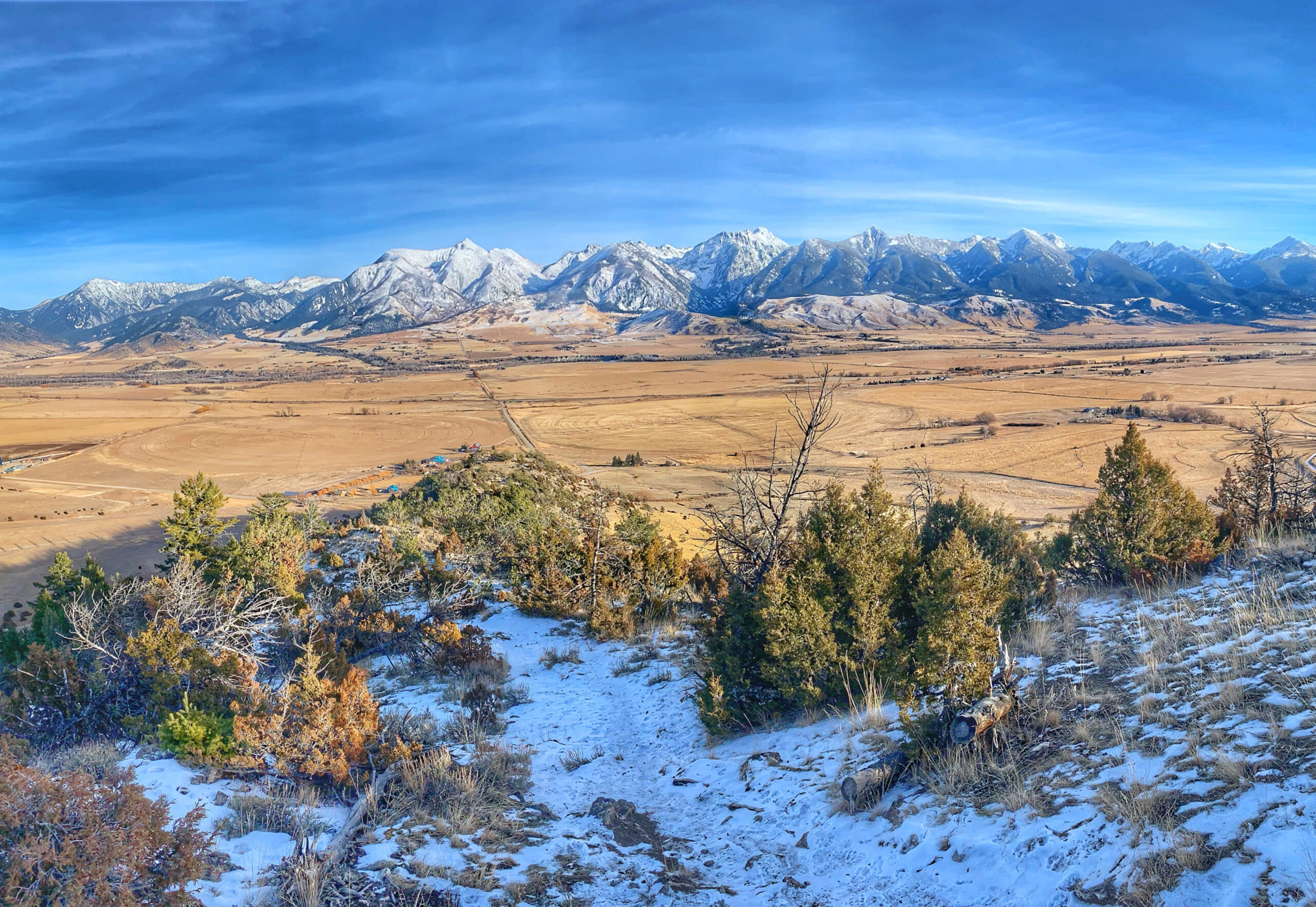
North of Yellowstone National Park’s famed North Entrance and south of the iconic town of Livingston, Montana, you’ll find Paradise Valley. Split in half by the majestic Yellowstone River and flanked to the east by the tower Absaroka-Beartoooth Mountains and Wilderness, few places inspire adventure as much here. While the area is best known for warm weather activities like fly-fishing, rafting, hiking, and camping, the winter months continue to present hours, days, and weeks of entertainment.
With hot springs to soak in and private ranches to cross-country ski, and take a sled-dog tour, those looking for paid adventures can easily find them. However, the options aren’t just limited to those with who made reservations. Not even close. There are dozens of destinations to choose from to cross-country ski, snowshoe, hike, or even just wander along the river, but I wanted to share some of my favorites. These seven spots are not the only outdoor adventure destinations for winter fun but are sure to whet your appetite for more snowy treks into the stunning scenery of Paradise Valley and beyond.
The best part of all of the adventure destinations is that they are free to access and enjoy! All you need is warm gear and a sense of adventure.
The Hogback
Distance from Interstate 90: 9.4 miles
Suggested Winter Activity: Hiking in the snow
Distance of Adventures: ~3 to 7 miles
Highlights: Stunning views of the Absaroka Mountains
Also known as the cow trail, Hogback is a local classic that rewards those who make the elevation gain adventure. Showing off the valley and surrounding mountains in all their glory, this trail will leave you in awe with each step. The route is steep, gaining under 1,000 feet of elevation in a mile. However, you don’t need to go up that far to take in the panoramic wonderland. While this may not necessarily be the easiest adventure out there, the views found here are second to none.
The full loop features 1,500 feet of elevation across seven miles, but this is typically far too difficult in the winter. Instead, work your way up to the highest point you can and take in the views. Please be aware that the trail is available to the public, except during hunting season in October and November, thanks to a conservation easement recently made accessible by the gracious landowners, Roy and Sandy Rose, so treat it with as much respect and reverence as possible. Do this everywhere you go!
Suce Creek Road and Trail
Distance from Interstate 90: 7.8 miles
Suggested Winter Activity: Cross-country skiing, snowshoeing
Distance of Adventures: ~ 4 miles
Highlights: Solitude, potential wildlife sightings
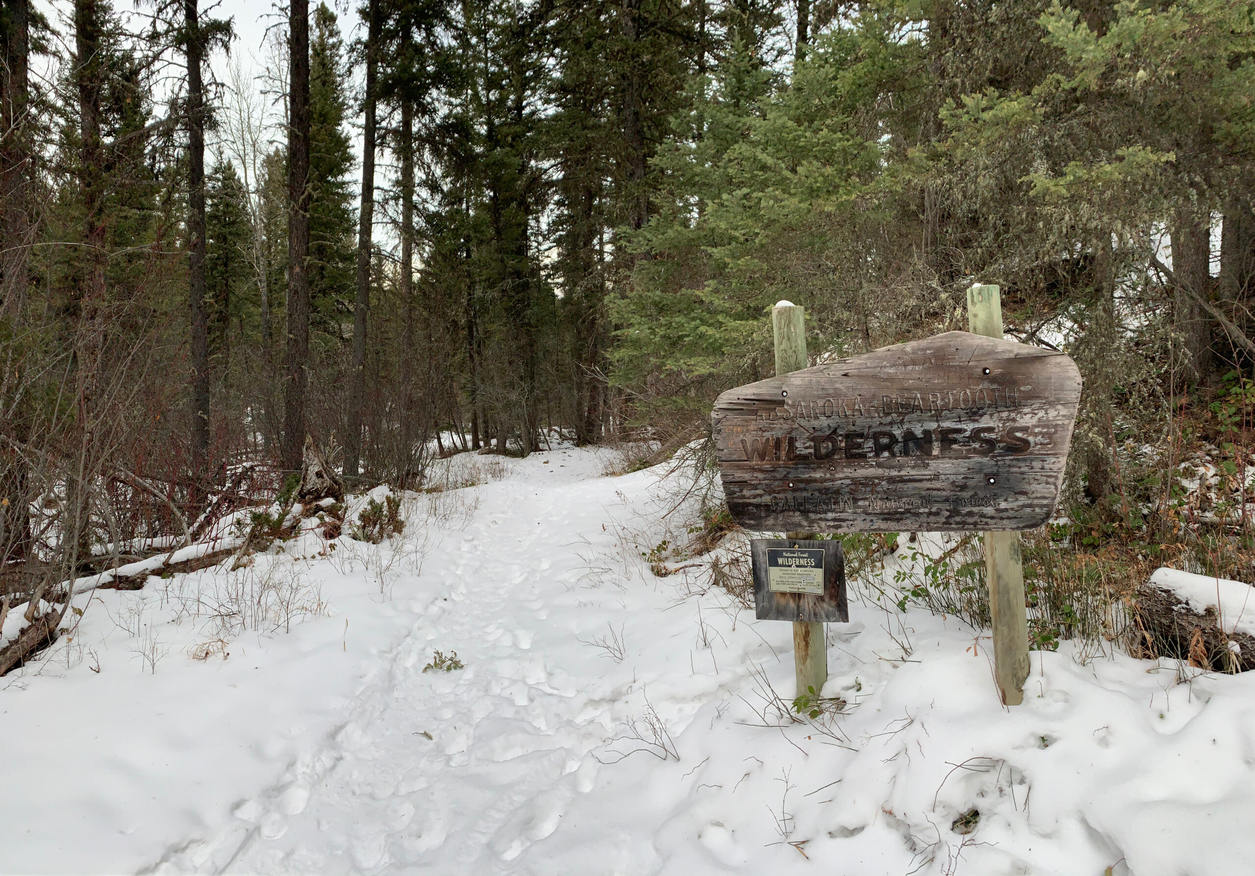
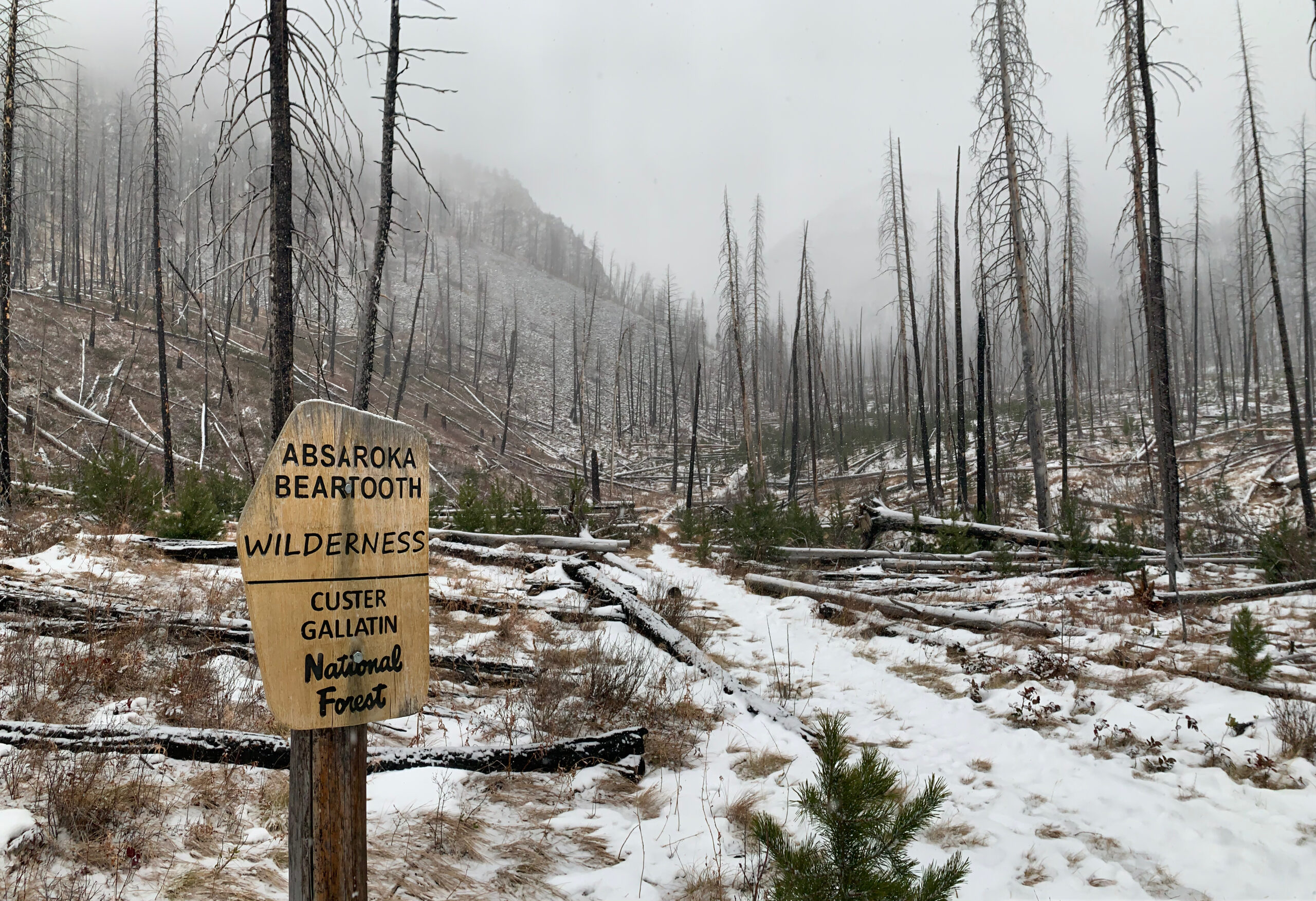
One of my favorite winter destinations close to Livingston is the road and trail at Suce Creek. In the summer, the road is fully open, leading to the trailhead which grants access to the nearly one million acres of the Absaroka-Beartooth Wilderness. In the winter, the gate on the road is closed one mile from the official trailhead, giving you a chance to hike, cross-country ski, or snowshoe the gentle grade to the clearing at the trailhead. From the trailhead, the trail climbs and drops over the next 7/10ths of a mile, reaching Suce Creek.
At the trail junction, hang a right and head into the wilderness area along a gentle incline for as long as you want. I typically turn around a little after the wilderness marker. If you want to do the whole loop and the conditions allow it, the entire day would be 8 miles in distance with 1,750 feet of gain. However, winters make the entire loop quite difficult and not so fun, so consider taking it easy and keeping your day to four or five miles. Keep an eye out for moose on this trail, as they are occasionally spotted near the wilderness marker.
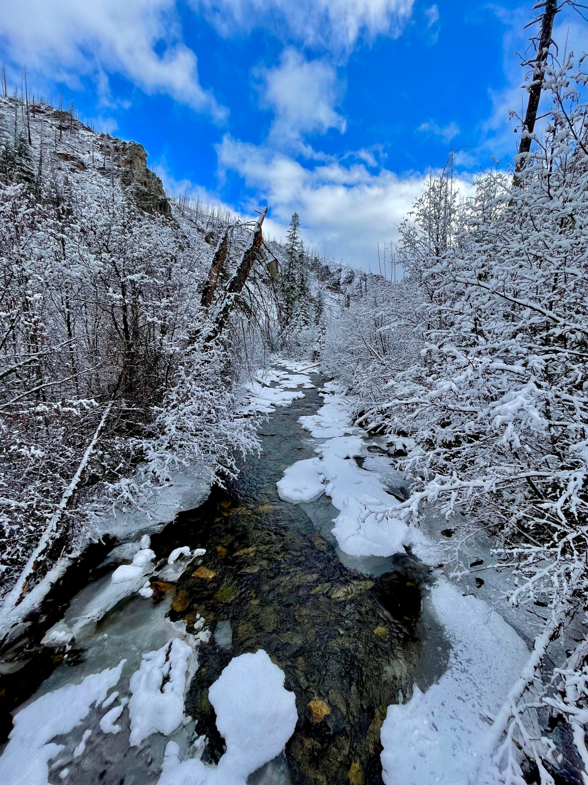
South Fork Deep Creek
Distance from Interstate 90: 10.3 miles
Suggested Winter Activity: Snowshoeing, snow hiking
Distance of Adventures: Up to 12 miles, but realistically 4 or so.
Highlights: Solitude, mountain views, potential wildlife sightings
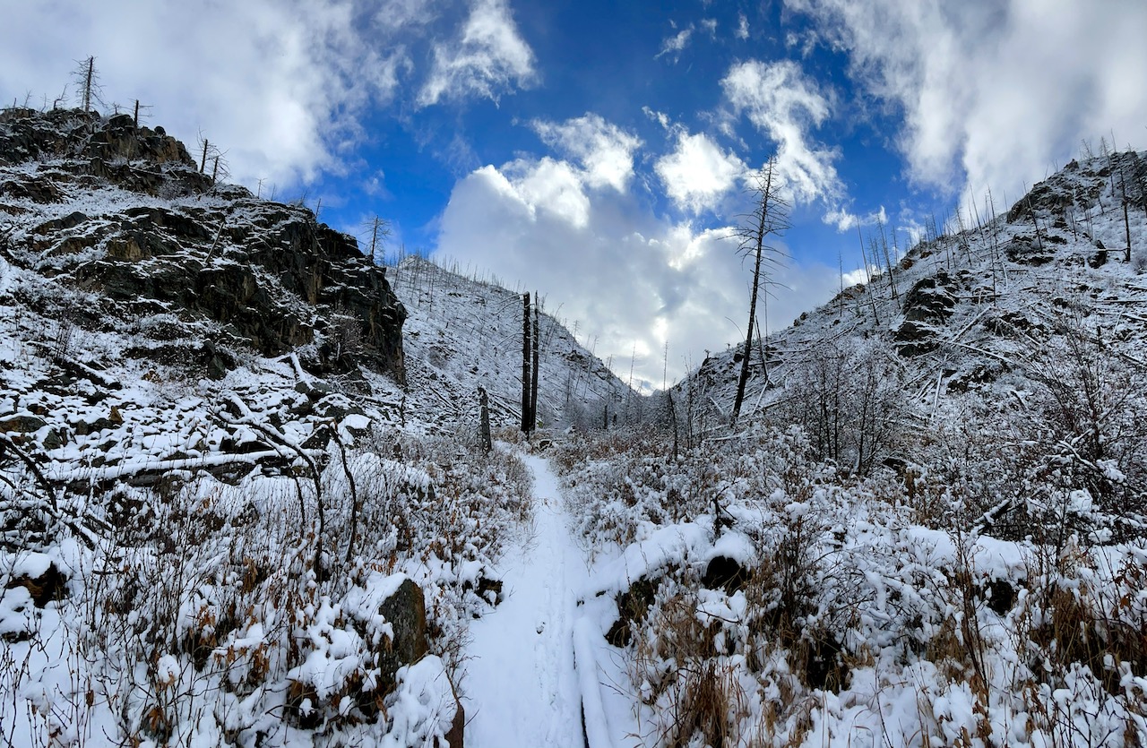
Not everyone will love this winter adventure, but those that do, really enjoy it. The trail starts simple enough if you can reach the trailhead via car. You may have to park and walk the road, which will add a few miles to your day. At the trailhead, you begin by climbing up a switchback trail in a clearing before reaching the ridge line and dropping into the canyon. In the first mile, you’ll gain about 600 feet of elevation, but that all comes in the first half. After the ridge, you’ll drop down and hike along the creek, which should be mostly frozen and gorgeous.
The one-mile mark is the bridge, which can be a turnaround point if you want. I typically head up to the wilderness boundary sign, which is about 1.5 miles from the trailhead and around 800 feet of elevation gain. While one could probably do some skiing up and down this, it is typically best suited for snowshoeing trips. Be aware that once you get below the ridge and into the canyon, the temperature will be much lower than on the westward-facing slope you just climbed up. This is also a great place to see wildlife, including moose, so keep your eyes peeled!
Mill Creek Road
Distance from Interstate 90: 27.3 miles
Suggested Winter Activity: Cross-country skiing, snowshoeing
Distance of Adventures: ~5 to 10 miles, if you go to Passage Creek Falls
Highlights: Stunning scenery and access to a trail into a remote canyon with a potential waterfall sighting.
Mill Creek is a classic spot for locals, so don’t expect to have this all to yourself. Known as a great spot to snowshoe and cross-country ski, heading up Mill Creek Road from the closed gate at Snowbank gives you access to a true winter wonderland. The road has a gentle grade, making this an ideal adventure location for those new to snowshoeing or cross-country skiing. Advanced snow sports adventurers will enjoy this just as much, as it provides an opportunity for some truly long day adventures, as you can follow the road for as long as you desire.
My favorite winter activity is to follow the road up to the Passage Creek Falls Trailhead and head into the Passage Creek Valley. The snow, frozen creek views, and the potential to see Passage Creek Falls fully frozen is an adventure that will leave you longing to return here often. If the route up Passage Creek seems too daunting, the trailhead makes for a great turnaround point, giving you a five-mile day out in the snowy wilds of the Absaroka Mountains of Montana.
Yankee Jim Canyon Trail
Distance from Interstate 90: 38.5 miles
Suggested Winter Activity: Snowshoe, cross-country ski, snow hike
Distance of Adventures: 4 miles
Highlights: River views, wildlife sightings, solitude
Tracing the old road that was used to connect Yellowstone’s North Entrance with the outside world, the Yankee Jim Canyon Trail is a worthwhile adventure during any season. In the winter, the old road and railway grade make for a picturesque winter trek along the Yellowstone River. Reached by driving toward Tom Miner, but hanging a left instead of going up the hill to the basin, the trail along the river is quickly becoming one of my favorite spots. Not only can see you signs used over a century ago, marking the road to Yellowstone, but you also walk past one of the older spots of civilization in the region, gain access to an interpretive trail, and get to see firsthand the power of the June 2022 floods through Yankee Jim Canyon.
This route is historical, gorgeous, and mostly overlooked by visitors and locals alike, giving you a chance to have a four-mile adventure all to yourself. The easiest route is to drop down to the river and follow the old railway grade through the canyon. If you are up for more of an adventure, you can make a figure-eight trip, climbing a few hills and passing those old painted signs marking the road to Yellowstone. No matter what you choose, I can almost promise you that you’ll enjoy your day immensely.
Pine Creek Road and Falls
Distance from Interstate 90: 11 miles
Suggested Winter Activity: Snowshoeing, cross-country skiing, snow walks.
Distance of Adventures: 6-10 miles
Highlights: Fantastic views, wildlife sightings, and the potential to reach a frozen waterfall.
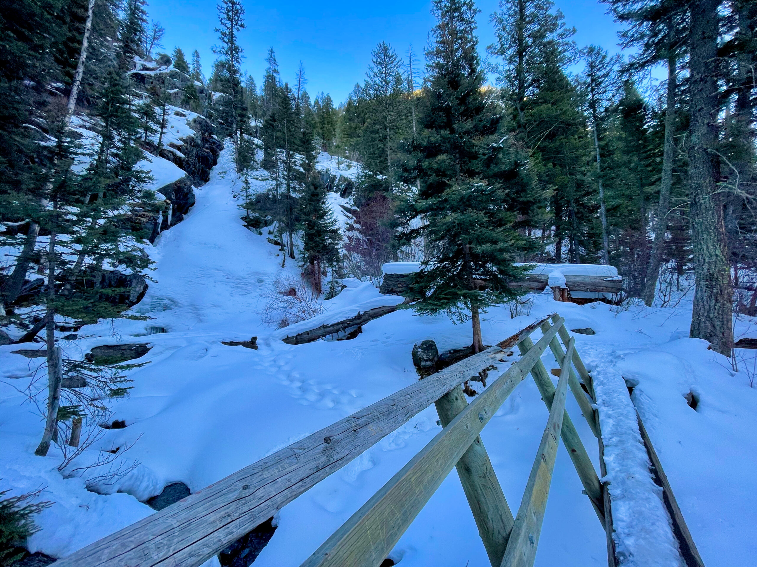
The hike up the road toward Pine Creek Campground offers sweeping views of Paradise Valley, snow-draped forests, and potentially a frozen waterfall. The hike up the road to the campground is pretty easy and one could do it in boots, snowshoes, or skis. To get to the falls, you’ll probably need traction devices of some kind, as the trail from the campground to the waterfall will be extremely icy and slow going. That being said, the waterfall in the dead of winter is an icy piece of art, showing how the warmth and cold create bubbles and ridges on a mostly frozen waterfall. Even if you don’t make it to the waterfall, the hike up to the campground and back is scenic, giving you a six-mile day from the start of the road to the end of the campground. You’ll also gain about 800 feet on the road alone, making this a perfect getaway.
One of the bummers about this adventure is that in previous years, one could park at the beginning of the road and walk up. Now, landowners have closed off the obvious parking area to all. If the snow is minimal along the first few miles of the road, you can drive up and find a place to park right before you enter the trees on the right side of the road. If the snow is too deep, you may have to park at Pine Creek Lodge and walk the East River Road to get to the road up to the campground and falls.
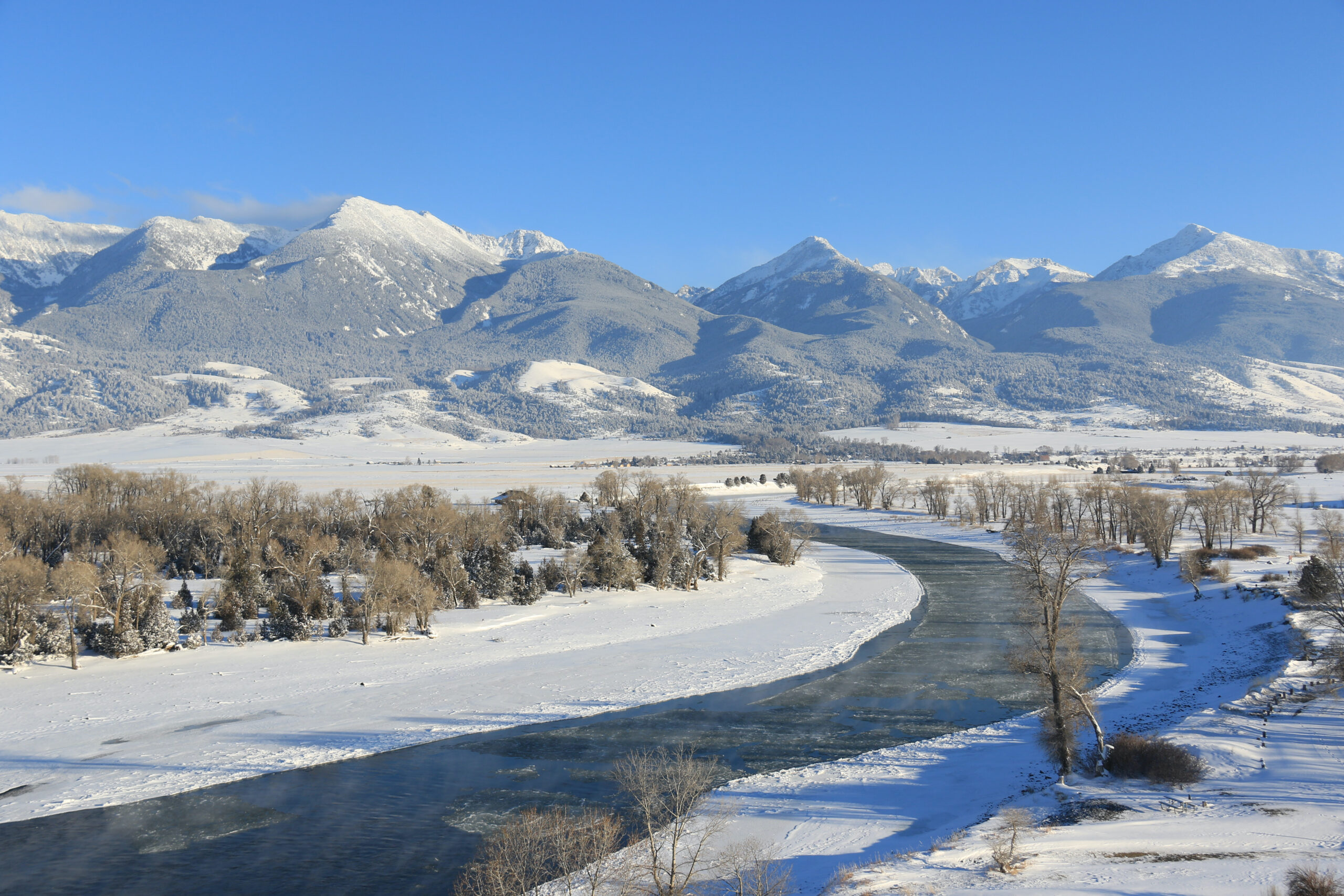
Mallard’s Rest and the Yellowstone River
Distance from Interstate 90: 11.5 miles
Suggested Winter Activity: Walking or snowshoeing.
Distance of Adventures: 2-4 miles
Highlights: Incredible mountain views, wildlife sightings, and a potentially frozen river
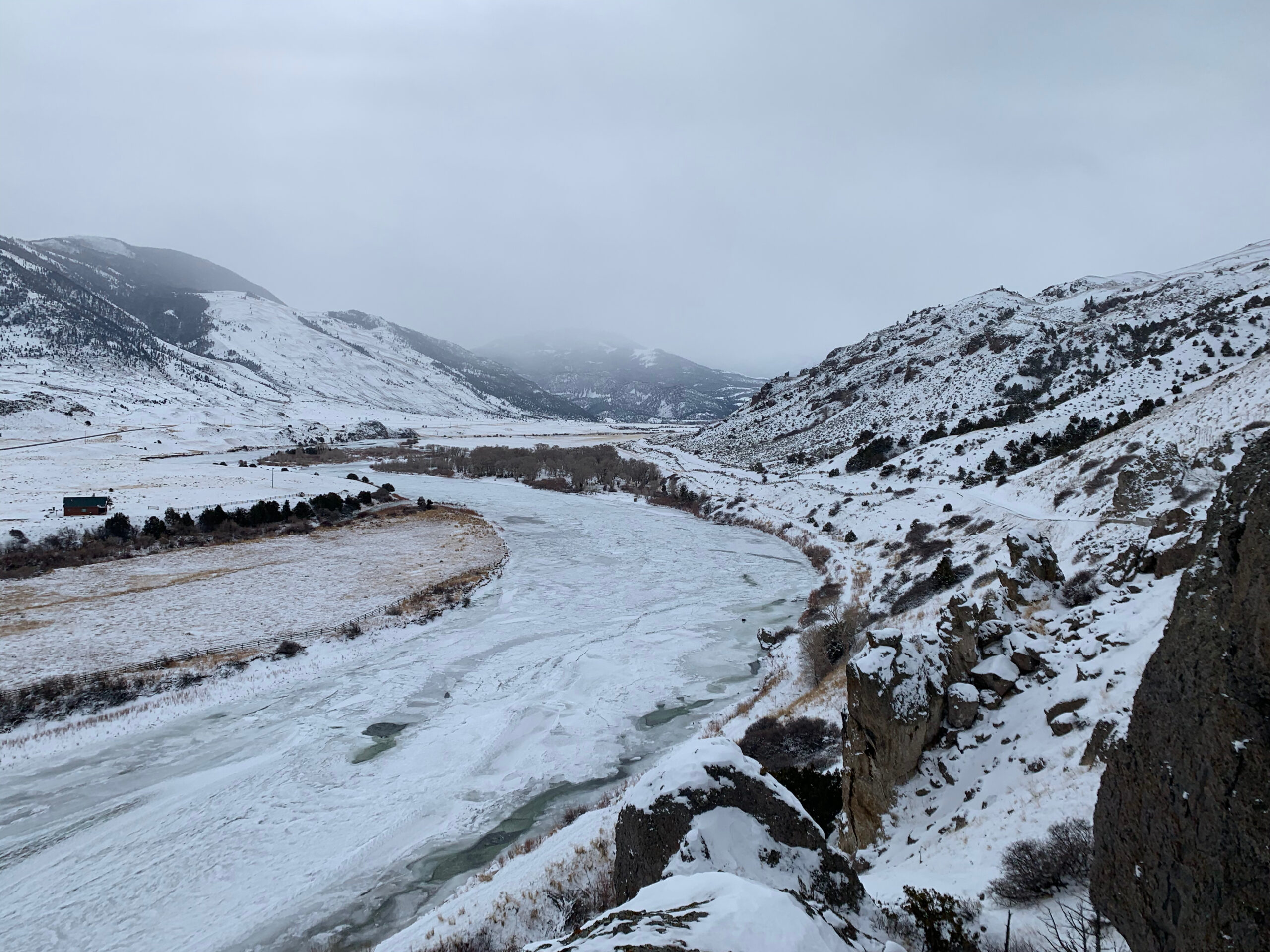
Mallard’s Rest is one of the best, easiest-to-access viewpoints in Paradise Valley. If you haven’t caught a sunset here, you are missing out on a potentially life-changing event. This isn’t hyperbole. This is one of the prettiest spots to visit, no matter what the season. In the winter, the horseshoe bend of the Yellowstone River often freezes, giving you a chance to take in the splendor with an icy foreground. Your adventure will start along the bluff, following the dirt road down to the campground. If you follow the road around the campground and along the river, you’ll get about two miles of activity and about 100 feet of elevation gain.
For some, that may be enough. If you want more activity and miles, consider following the river by walking along the bluff and dropping down to the riverbank on the north side of the river bend. From here, you can walk along the riverbank for as long as you want. Just know you have to walk back. Keep an eye out for beaver, deer, elk, and eagles when hanging out here, as they are commonly seen.
As Always…
As always, know your limits and always check the weather and road conditions before heading out. This is rural Montana and more often than not, if something goes wrong, you’ll be out of cell service and no one will be around to help. Be safe, always tell someone where you are going, and stick to the trail/route you told them. Bring an extra layer, plenty of food and water, and know when sunset is. This isn’t a place to make a mistake.
Hoping to Experience Hikes in and Around Yellowstone that Lead You Beyond the Boardwalks?
Embark on a journey Beyond the Boardwalks and experience the breathtaking beauty of the Greater Yellowstone Ecosystem through invigorating hikes! I’m here to make it happen.
Offering private hiking tours throughout the year, I’ll guide you to hidden gems and stunning trails that reveal the park’s true wonders. Additionally, I’ve compiled my 50+ favorite hikes in and around Yellowstone in a comprehensive guidebook.
Let’s turn your adventure into an unforgettable day out enjoying nature’s marvels. Join me Beyond the Boardwalks!