This week in Yellowstone National Park, from May 15th to May 21st, I will talk about a lake on the Continental Divide, share some openings in the park, let you know of a newly opened waterfall trail, tell you to drive the East Entrance Road, and inform you about the wild weather you should expect during the springtime in Yellowstone. I will also give you the weather forecast, wildlife report, and everything else you need to have an incredible time, “This Week in Yellowstone.”
LISTEN TO THIS AS A PODCAST!
Apple: https://podcasts.apple.com/us/podcast/this-week-in-yellowstone-national-park/id1789397931
Spotify: https://open.spotify.com/show/41E5WWldz4s7n6NXh2Lahr
RSS: https://rss.com/podcasts/this-week-in-yellowstone-national-park/
Disclaimer: I might miss a few details, so feel free to reach out with questions! I also mention park locations casually—if you’re unfamiliar, a quick search can help. This report only covers drivable areas of the park.
Also, these posts are a passion project—I’m not paid or sponsored. If you’re enjoying it, I’d love a review or a quick email! To support my work, check out my guidebooks on hiking and wildlife watching, or join me for a guided Yellowstone tour. For details, visit outdoor-society.com or reach out directly!
THIS WEEK’S YELLOWSTONE NEWS
This week, the news is pretty slow out of Yellowstone National Park. The biggest news is that the amenities at the Canyon Lodge and Cabins are opening on the 16th. The Fishing Bridge General Store is also opening on the 16th, as is the Grant mini store. Most everything at Mammoth and Old Faithful is also open at this time.
Other than that, the usual shenanigans have been occurring in the park. People are getting too close to bears, stopping their cars on the road and exiting their vehicles, and generally just getting caught up in the excitement of being in Yellowstone. No major incidents have occurred, and 99.99% of all park visitors are on their best behavior. I suppose I should use this time to remind everyone that dogs are not allowed on trails in Yellowstone National Park. I was hiking over the weekend and saw a couple with their two large dogs down at the Helloraring Suspension Bridge. I talked to them and they pretended not to know the rules, but I could tell they were lying.
The last bit of news I have isn’t really news. It is just a reminder that the entrance at West Yellowstone is backing up on a pretty regular basis in the mornings. Usually just on weekends, but as we get deeper into the month, those lines will be present every morning, weekday, and weekend. I’ll talk more about this and how to avoid the lines in the coming weeks.
EXPERIENCE OF THE WEEK
Driving from Fishing Bridge to Yellowstone’s East Entrance is one of those underrated journeys that ends up sticking with you long after you’ve left the park. It’s not just a way out—it’s a whole experience packed with lake views, mountain passes, peaceful forests, and maybe even a surprise wildlife encounter or two.
You start at Fishing Bridge, which feels like a gentle threshold between the bustling heart of Yellowstone and the quieter eastern wilderness. The bridge itself spans the Yellowstone River right where it pours out of Yellowstone Lake, and while you can’t fish here anymore (it’s a protected spawning area for cutthroat trout), it’s still a great place to watch for fish in the water—and sometimes even a bear or two nosing around. The visitor center nearby is worth a quick look; it’s one of those old stone buildings full of character, and the exhibits on native fish and the lake’s ecology are surprisingly fascinating. There’s also a general store and a little museum tucked next door—great for grabbing a snack or browsing the classic souvenirs.
As you leave Fishing Bridge and head east, the road hugs the northern edge of Yellowstone Lake for a good stretch. It’s a gorgeous drive, especially in the morning when the lake is still and the mountains are mirrored in the glassy surface. The Absaroka Range begins to peek up on the horizon, and if you keep your eyes on the sky and the treetops, you might spot bald eagles or osprey circling above. You will also see bison, numerous other birds, and even a few scenic thermal areas.
If you’re up for a little side adventure and the weather is good, take the short turnoff to Lake Butte Overlook. It’s a quick detour but gives you an incredible panoramic view of the lake, the surrounding forests, and even the Grand Tetons way off in the distance on a clear day. It’s peaceful up there, and you’ll often have it mostly to yourself, just you, the wind, and the view.
As the road curves away from the lake, you enter a thicker forest of lodgepole pines. This is when the drive starts to feel more remote, like you’re slipping into a quieter part of the park. The climb toward Sylvan Pass begins gradually, and the scenery becomes more dramatic with each mile. The forest here is known for wildlife, especially in spring and early summer. It’s not unusual to spot a black bear or even a grizzly foraging near the road, so it’s worth slowing down a bit and watching the tree lines. Elk and moose are more elusive, but not impossible to spot.
Just before the top of the pass, there’s a pullout at Sylvan Lake, a small alpine lake tucked into the trees. It’s one of those quiet gems that people often drive past without noticing, but it’s absolutely worth stopping for. The water is calm, and the reflections of the surrounding slopes give the whole place a storybook feel, especially if there’s still a bit of snow lingering nearby or the early fall colors are starting to turn.
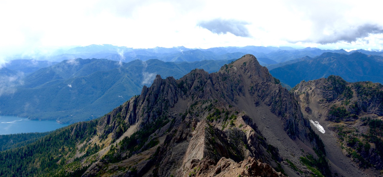
Then you reach Sylvan Pass itself, the high point of the drive, both in elevation and in drama. At about 8,500 feet, the views open up to jagged volcanic ridges and avalanche-carved slopes. The road snakes through rock walls and steep drop-offs, so it’s best to take it slow and enjoy the scenery. You’re truly in alpine country up here. It’s one of the most avalanche-prone areas in the park, which is why it’s carefully managed in the winter and one of the last sections to open in the spring.
As you begin your descent, the Absaroka Mountains start to dominate the view. Their sharp, rugged peaks loom on the horizon, and the road winds down through thick woods and past old avalanche paths. There are a few signs and small pullouts where you can stop and take in the dramatic landscape, and maybe catch a glimpse of some lingering snow on the higher ridges.
Eventually, you’ll reach the East Entrance sign, perfect for a photo if you’re entering the park, or a farewell snapshot if you’re on your way out. But don’t put your camera away just yet. Just outside the park, the scenery continues to impress. You’ll head into Shoshone National Forest and start driving along the Buffalo Bill Scenic Byway toward Cody, one of the most beautiful stretches of road in the West. The North Fork of the Shoshone River winds beside you, and the cliffs and red rock formations here are absolutely stunning.
So while this route doesn’t have the major geysers or crowds, it offers something just as special: quiet beauty, mountain drama, and a real sense of wilderness. It’s perfect for slowing down, rolling the windows down, and just soaking in the raw, scenic soul of Yellowstone.
TIP OF THE WEEK
Expect Wild and Wacky Weather in May and Early June
One of the most common questions I am asked when people book a tour with me is what to expect with the weather. Because of the unpredictable nature of the weather in Yellowstone in the late spring, I tell them to be prepared for anything. I clarify that by “anything,” I mean anything.
While most of the country seems to be in the throes of good weather, now that spring is here and we are approaching summer, things are a little different here in Yellowstone. The month of May and early June will see rain, snow, wind, sun, thunderstorms, and pretty much anything else possible in the region. What makes it fun is that the weather I just mentioned could all happen in 24 hours. Highs may be in the 70s, and lows could be in the teens. It will snow again in May. Maybe two or three more times. It could also snow in June. It has also snowed in July and August in the park before, so just know that the “usual” weather for the spring and summer is more dramatic in the Rocky Mountains. The one thing to know about the late-season snow is that it rarely sticks around for long. While it may impact travel for an afternoon, evening, and morning, it rarely lasts more than a day before it has melted away. The park also does a fantastic job of clearing the roads and closing roads when they are unsafe
When packing for your trip to the park, know that you’ll need a little something for everything. Bring a rain jacket and rain pants, bring a warm thermal layer in case it is cold and snowy, and bring clothes for when it is sunny and warm. One other thing I tell people when they are visiting is that while the high says it will only be 70, that 70 degrees will feel much hotter, as you are at elevation. Even people who live in humid climates and think they will be fine with the heat because they live in a warm and humid place are shocked at how hot it can get. Just be ready, stay hydrated, and you should be just fine.
Random Yellowstone Fact of the Week
Isa Lake
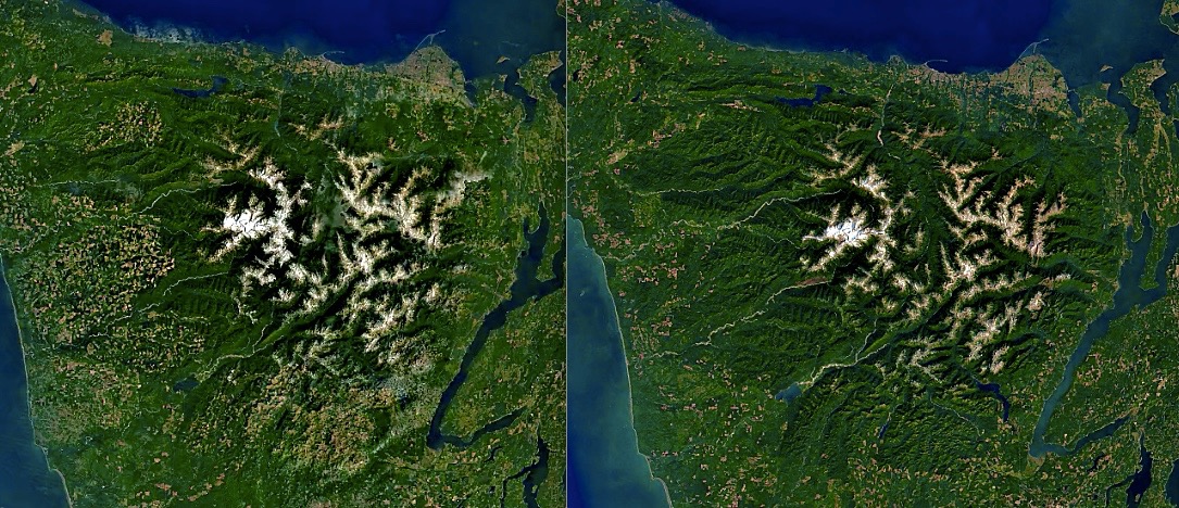
No, that isn’t Mario saying it’s a lake. Instead, it is a cool location in the park right at the Continental Divide. Isa Lake is a quirky little gem tucked away in Yellowstone National Park, right at Craig Pass along the Continental Divide. What makes this lake extra special is its unique drainage pattern. Historically, Isa Lake was one of the only known lakes in the world where water drained in two different directions—toward both the Pacific and Atlantic Oceans. Even more mind-bending, it did this backwards: the east side of the lake flowed to the Pacific, and the west side flowed to the Atlantic. That oddball drainage likely only happens now during peak snowmelt after especially snowy winters, but it’s still a cool natural phenomenon.
You’ll find Isa Lake right by the road between Old Faithful and West Thumb, making it an easy roadside stop for travelers exploring the southern loop of the park. The spot has long been recognized for its uniqueness, and in the 1930s, when park engineers were building out the Grand Loop Road, they had to find a way to cross this fragile area without messing up the lake’s natural flow. The solution? The Isa Lake Bridge, completed in 1942. It allowed cars to pass over while keeping the environment below relatively undisturbed.
By the early 2010s, though, the old bridge had seen better days. The National Park Service put together a reconstruction plan in 2013 to update the bridge with modern materials while preserving its historic appearance and scenic value. The idea was to make it safer for today’s traffic while still respecting the lake’s natural and cultural significance.
Beyond its quirky drainage and historic bridge, Isa Lake is also a peaceful, scenic spot. During summer, yellow pond-lilies dot its surface, adding a splash of color to the calm waters. While it’s not one of the park’s headline attractions, Isa Lake offers a quiet moment of wonder that ties together Yellowstone’s natural history and human efforts to preserve it.
The lake was first documented by Hiram M. Chittenden, an Army engineer instrumental in developing Yellowstone’s road system. In 1891, while surveying routes between Old Faithful and the West Thumb Geyser Basin, Chittenden encountered this small, high-elevation lake. He named it after Miss Isabel Jelke of Cincinnati, though the specific reason for this dedication remains unclear. Chittenden’s choice reflects the era’s tradition of naming natural features after acquaintances or notable individuals.
So if you’re cruising along the Grand Loop and spot a pullout near Craig Pass, take a moment to stop. Isa Lake might be small, but it holds a fascinating story about nature, geography, and the care taken to protect even the quieter corners of Yellowstone.
WEATHER FOR THE COMING WEEK
If you enjoy wet weather and cooler temperatures, this week is for you!
Lamar Valley: Thursday will see a high in the mid-40s and a low slightly below freezing, with a slight chance of rain showers throughout the day. Friday will be similar, just a few degrees warmer and heavier rain in the evening hours. Saturday is currently said to be drier, with only a 24% chance of rain, with a high of 55 and a low of 35. Sunday will be about the same, with rain developing in the late morning/early afternoon, totaling up to just under a half-inch. Monday will be partly sunny, with highs in the low 50s and lows around freezing, then Tuesday will see temperatures drop into the 40s and lows in the upper 20s with a chance of rain, before drying up and warming up on Wednesday.
Gardiner: Thursday will be decent in Gardiner and Mammoth, with partly sunny skies and a high around 50, and a low in the 30s. Friday will be about the same, with more clouds and late rain developing. Saturday will start out cloudy and rainy, and then clear up a bit, potentially cracking 60 degrees and possibly seeing some rain showers. Sunday will be wet, with almost a half-inch of rain in the forecast, a high in the 50s, and a low around 40. Monday and Tuesday will also be wet, with highs in the 50s and lows in the 30s. Wednesday sees the return of sun and warmth.
West Yellowstone: Thursday will see a high in the mid-40s and a low slightly below freezing, with a slight chance of rain showers throughout the day. Friday will be similar, just a few degrees warmer and heavier rain in the evening hours. Saturday is currently said to be drier, with a 50% chance of rain, with a high of 55 and a low of 33. Sunday will be about the same, with rain developing in the late morning/early afternoon, totaling around a third of an inch. Monday will be partly sunny, with highs in the low 50s and lows around freezing, then Tuesday will see temperatures drop into the 40s and lows in the mid-20s with a chance of rain, before drying up and warming up on Wednesday.
Old Faithful: High temperatures on Thursday through Sunday will be in the mid-40s to low 50s, and lows will hover around freezing. Expect snow flurries and maybe some accumulation at the higher elevations, with rain showers throughout those days. Currently, Sunday looks to be the wettest day, seeing 1/3rd of an inch, most coming in the afternoon hours. Monday looks to be partly sunny with a high near 50 and a low near 30, then showers return on Tuesday, with a high of 47 and a low of 26, before things look to clear up and dry out starting Wednesday.
SNOWPACK UPDATE
The snowpack as of May 14th, 2025, is decent, but not great. The interior of the park is around 68% of normal, and while the wet weather in the forecast will fall as snow in the higher elevations, I don’t expect this number to rise. The mountains surrounding the park are fairing better, with an average around 80% of normal.
ROADS CONDITIONS
With no real snow or serious precipitation in the forecast, roads should be great. However, keep alert for any construction vehicles on the road and potential delays starting near the old and new bridge site by Tower Junction. The construction work probably won’t be happening this week, but it is better to expect it early and be happy when nothing is going on.
There will also be some construction work going on near the buffalo ranch in Lamar Valley, impacting the pullouts in the area.
For up-to-date information, call (307) 344-2117 for recorded information, or sign up to receive Yellowstone road alerts on your mobile phone by texting “82190” to 888-777.
CAMPING INFO
This week, more camping options start to open up. As always, Mammoth Hot Springs campground is open. The Madison Campground near the West Yellowstone entrance is now open. The Fishing Bridge RV Park is also open. Bridge Bay opens on the 16th.
WILDLIFE WATCHING UPDATE
You have to listen to the podcast to get this information. Sorry.
Apple: https://podcasts.apple.com/us/podcast/this-week-in-yellowstone-national-park/id1789397931
Spotify: https://open.spotify.com/show/41E5WWldz4s7n6NXh2Lahr
RSS: https://rss.com/podcasts/this-week-in-yellowstone-national-park/
HIKING NEWS AND UPDATES
Like the last few weeks, we are in this weird flux of some trails being open, some trails being snowy, some trails being muddy, and some trails being closed for wildlife. Since this episode is going to be a little long, and I don’t feel like listing every trail and its conditions, I am going to let you know that if you contact me and ask about a trail, I will happily tell you how it is. I will also refer you to the Yellowstone National Park Backcountry Situation Report.
TREK OF THE WEEK
Osprey Falls is Back Open!
While Osprey Falls opened last year, nobody really mentioned it or brought it to anyone’s attention. It silently sat, waiting to be discovered as open for those who knew to check the backcountry situation report website. For everyone else, it remained a secret. In 2022, the flooding that impacted travel in Yellowstone also washed out a few trails. The Osprey Falls Trailhead was one of those paths. Now, it is back open and ready to be enjoyed!
The reason I am suggesting Osprey Falls this week is for two reasons. The first is that Bunsen Peak is still a bit snowy, but I really wanted to recommend something near Mammoth. The other reason Osprey Falls, and any waterfall, is worth seeing right now is that the snow is starting to melt and the water levels are rising. Rivers and creeks are running high, and waterfalls are starting to rage. We still have a month or more of melt-off, but things are picking up, and you should see the power of the waterways of Yellowstone.
There are a few ways to reach Osprey Falls, but for simplicity and brevity, I will give the most common route. If you want the back way, send me a message.
To reach Osprey Falls, park at the Bunsen Peak Trailhead at the start of Swan Lake Flats after leaving Mammoth. Instead of turning left on the Bunsen Peak trail, follow the Old Bunsen Peak Road through grassland and burned forest for about 3 miles to Osprey Falls Trail. Once at the trailhead to Osprey Falls, descend 700 feet into Sheepeater Canyon, one of the deepest canyons in Yellowstone National Park. Osprey Falls, on the Gardner River, plunges 150 feet over the edge of a lava flow. Be aware that the trail down to the falls is incredibly steep and has some loose dirt and rock. This is not a family-friendly trail and should not be attempted by those new to hiking.
The good news is that you can see the waterfall from the top of the Osprey Falls Trailhead if you don’t want to hike down to the falls. Another awesome feature of this trail is that the Bunsen Peak Road section is bikeable, so you can hop on your gravel or mountain bike and ride it to the Osprey Falls Trailhead, giving you a much easier day.
The total distance for this hike is a little over nine miles, and you’ll gain roughly 1,000 feet in elevation, mostly from the hike back up to the road from the falls. When the snow melts enough to summit Bunsen Peak with ease, considering doing the summit and a waterfall for an 11-mile day with nearly 3,000 feet of gain.
NEXT WEEK
In next week’s edition, I’ll return with all of the information you need to have a good week in the park, including wildlife, weather, and trail updates.
Until then, happy trails!