“In every walk with nature one receives far more than he seeks.” ~ John Muir
I hike to Lake of the Angels a lot. I hike it so much, I have every inch of the trail memorized.
The eight mile roundtrip trail is why I have quads of steel, and an unquenchable wanderlust. It is the trail that spoils me with unparalleled beauty each and every time I hike it, and honestly, I feel like I don’t visit it often enough. I hike the trail at least every season, usually more, and yet each and every time on the trail and at the lake, I discover something new, or see the adventure through another perspective. My last trip up on Friday 8th, 2015 was no different.
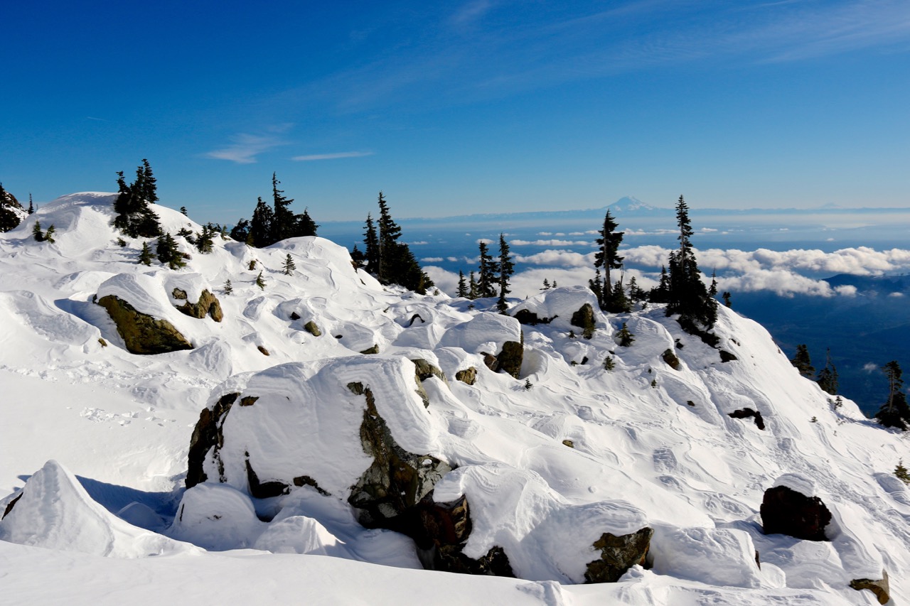
On this trip to Lake of the Angels, I discovered the beauty and ruggedness of Mount Skokomish, 1,600 feet above Lake of the Angels. While I failed to reach the summit, missing it by 400 feet thanks to crummy snow, I did get new views of the region, and a better understanding of what it takes to hike and summit a mountain in a day. While I will go into detail about the climb later, for now, I will share the beauty of Lake of the Angels.
Lake of the Angels is located on the eastern side of Olympic National Park, most easily accessed by hiking the Carl Putvin Trail along the Hamma Hamma River. Just a few miles along a well-maintained dirt road past the Lena Lake Trail, this hike is comparatively empty. Starting out in the Olympic National Forest, the trail steeply climbs along Whitehorse Creek, eventually entering the Mount Skokomish Wilderness, one of six wilderness areas on the Olympic Peninsula. Gaining 3,358 feet in elevation over nearly four miles of hiking, the Carl Putvin/Lake of the Angeles Trail is one of the steepest, and most rewarding day hikes in the State of Washington.

The trail starts out steep, but not in hindsight. During the first 1.3 miles, the path gains nearly 900 feet, crossing over three drainage areas that, when wet, can be tough. With incredible views of the Hamma Hamma River Valley and Mount Pershing, this first section, in the forest, is scenic and rewarding in its own way. While many will take their time up this first section of the trail, I test myself and see how well I feel. I am a fast hiker, so right out of the gates I power up, knowing that the steepness I am feeling is nothing compared to what is next. At 1.3 miles, the trail meets an old forest service road, now grown over. Heading downhill for a few along this path, the trail soon meets the main trail to Lake of the Angels.

Over the course of the next 1.5 miles, the trail gains 1,630 feet in elevation, mostly through wooded areas, up a ridge, eventually leading to a headwall. The headwall is the reason most never hike to this lake, but that is because of misleading trip reports making it seem like a death defying scramble. Instead, the section of the trail right before and the actual headwall itself are manageable, if you trust yourself and are safe. The headwall has a bad reputation, but it is underserved. Every single time I have hiked this trail, the headwall is always a sign that I am almost done with serious elevation gain for awhile. Climbing up the sturdy roots and juggy rocks is easily done, as long as you are patient and smart. The headwall can be done by most moderate hikers, especially after the serious steepness and loose dirt/rock trail leading toward it.

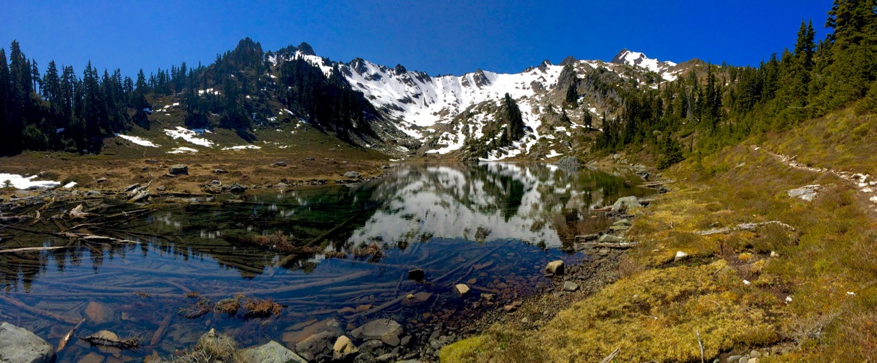
Past the headwall, the trail levels of a bit in comparison to the craziness of the last section, leading through a small valley and over another ridge before arriving in the Valley of Heaven. The Valley of Heaven can be confusing to those unfamiliar with the area, and route finding skills are needed during the majority of the year. However, before the trail gets a bit hard to follow, take some time and enjoy the view of the Pond of the False Prophet. With clear waters that often reflect the snow peak in the distance, stopping here for pictures, a drink or two and a snack is something I highly recommend.

As the trail weaves through the muddiness of the valley, keep an eye out for trail markers and there path. Most trails do lead to the right area, but the general rule of thumb is to continue Northwest, where the final climb will take place. Before the last elevation gain, the trail finally enters Olympic National Park, as marked by a sign. Past the sign, you must gain another 338 feet of elevation over 7/10ths of a mile, something many weary legs will not want to do. While your thighs, quads, lungs and brain may be screaming at you, the view as you round the final corner and see the Lake of the Angels will reenergize you and make it all worthwhile.

Lake of the Angels isn’t big, taking around 10 minutes to circumnavigate, but what it lacks in size it makes up for in stunning beauty. Home to mountain goats, marmots, and stunning views of Mount Skokomish and Mount Stone reflecting off the clear water, the area around Lake of the Angels gets more breathtaking with each trip, and each new view to discover. As your hiking stamina and familiarity with the trail increases, take some time and do what I do, explore the area.
SEE MORE RECENT PICTURES ON MY FLICKR PAGE.
WANT MORE OLYMPIC BACKPACKING AND HIKING OPTIONS?
Order the new Olympic National Park Guidebook by Author Doug Scott. At 400+ pages, with over 70 detailed trail descriptions, hundreds of images of locations, descriptions to lodges, campgrounds and dining, as well as a city guide around the Olympic Peninsula, this guidebook will lead you on the greatest adventure Olympic National Park has to offer.
The e-book is available in full color, while the paperback is currently released in black and white to keep printing costs down. If you love Olympic National Park, or interested in exploring the nearly one million acres of wilderness, this guidebook will become a favorite.


