As a resident of the Puget Sound Region of the PNW, I never expect a White Christmas. If you are a resident of Western Washington, you shouldn’t either. Over the last century, the city of Seattle has only had four Christmas Days with snowfall. In outlying areas, the total is higher, but not much. In the Pacific Northwest, snowy holidays are what we see on Instagram or what we hear crooned on our holiday Pandora station. Around the Puget Sound, Salish Sea and wilderness coast, if we crave a snowy Christmas experience, we usually head to the mountains. This year, with an above average snowpack for the entire Pacific Northwest, you can have a white Christmas with ease. While my last two snowpack articles have been full of data and a bit long winded, this is going to be short and sweet so we can all enjoy the holidays.
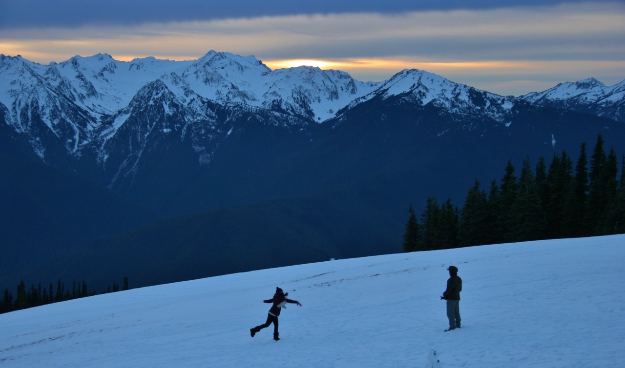
As Christmas Eve greets the Pacific Northwest, the sun is out in some areas around the Olympic Mountains, letting them glisten in the cool, crisp sun. Two years ago, Hurricane Ridge had just 20 inches of snow and would have a high snowpack of 25 inches for the entire winter. This year, the Olympic Mountains are 135% of normal and have 157% of above average precipitation. This has been a wet year and our snowy mountains are enjoying the benefits of that. Avalanche Danger because of the snow is quite high, so it would be wise to avoid any areas where unstable snow exists.
The Waterhole Weather Station, located 200 feet below Hurricane Ridge, has a snowpack of just under 55 inches of snow so far, but the area hasn’t seen significant snowpack growth over the past week. In the last seven days, just 8 inches of snow have remained just below Hurricane Ridge. This area is 126% above normal.
Elsewhere around the Olympic Mountains, the snow is stacking up. Above the Dungeness River in a drier section of the Olympic Mountain Range, the snowpack is 25 inches at 4,010 feet. Last year, the snowpack for Christmas day at this location was 30 inches, so we are a little below that. However, this station is still at 165% of normal, according to the USDA monitor data.
The Buckinghorse Weather Station, located at 4,870 feet, is currently offline. This is a bummer, but the snowpack there is higher than normal. That translates into an above average snowpack for all western Olympic peaks.
Finally, at Mount Crag near Hood Canal, the weather station is also reporting great news for the Olympic Mountain snowpack. At 3,960 feet, the station is reporting a snow depth of 52 inches, slightly down from last year’s 64 inches on Christmas Eve. In the past week, the Mount Crag station has received 11 inches of snow. Not too shabby! They are at 139% of normal, so that is awesome.
Those hoping to get out and enjoy the snow in Olympic National Park and Forest will have have their best luck at Hurricane Ridge, above Port Angeles. This area offers snowshoeing, skiing, snowboarding and even ranger-led adventures in the powdery paradise.
WHAT YOU NEED TO KNOW TO VISIT HURRICANE RIDGE
- Weather permitting; the Hurricane Ridge Road is scheduled to be open Friday through Sunday and Monday holidays from November 25, 2016 through March 26, 2017. The road will be closed on Sunday, December 25, Christmas Day and is scheduled to be open daily from Monday, December 26 through Monday, January 2, 2017.
- All vehicles, including four wheel drive, are required to carry tire chains when traveling above the Heart O’the Hills entrance station between Thanksgiving and the last weekend of March. “Having a set of chains in every vehicle gives an extra safety margin when road conditions worsen during the day,” said Acting Superintendent Spector.
- Winter storms can close or delay opening of the Hurricane Ridge Road; high winds and blizzard conditions are not uncommon. Road and weather condition updates are available on the park’s Road and Weather Hotline at (360) 565-3131 or @HRWinterAccess on Twitter.
- The Hurricane Ridge Road may also close temporarily if the parking lot becomes completely full. Park staff urges Hurricane Ridge visitors to carpool and pay extra attention to making the best possible use of the parking area.
- Weather permitting, Hurricane Ridge Road usually opens at 9:00 a.m., but times vary according to road and weather conditions. The road closes to uphill traffic at 4:00 p.m. and all vehicles must exit the Heart of the Hills entrance station by 5:00 p.m.