Yellowstone National Park, renowned for its dramatic landscapes and abundant wildlife, also offers a plethora of easy hikes that make its natural wonders accessible to everyone. From the tranquil shores of Lost Lake to the breathtaking views of Grand Prismatic Hot Springs, these short and relatively flat trails invite hikers of all ages and abilities to explore the park’s diverse beauty. Whether you’re strolling along the scenic Storm Point Trail by Yellowstone Lake, marveling at the geyser eruptions on the Lone Star Geyser Trail, or discovering the vibrant thermal features on the Artist Paint Pots Trail, Yellowstone’s easy hikes provide unforgettable experiences without the strenuous effort, allowing you to immerse yourself in nature’s splendor at a leisurely pace.
Lost Lake
Located near the Petrified Tree and Roosevelt, the Lost Lake Loop is a fun little jaunt in north Yellowstone. To make this the easiest route possible, start the hike at the Petrified Tree. From there, walk down the short hill and the trail quickly levels out. After passing through a narrow spot along the seasonal creek, you’ll round a corner and reach the lake in less than a mile. The end of the lake is one mile from the start of the trail. Be aware that in the spring, summer, and fall months, bears, bison, and elk frequent this trail. Keep an eye out for birds around the lake, too!
Add More: If you want to add a little extra, definitely consider hiking another mile along the trail to reach a hidden canyon rim and a glimpse of Lost Creek Falls. You’ll cross a few small bridges and be mostly in the woods for this section.
Lava Creek (Top Section Only)
Starting at the Lava Creek Picnic Area, a true gem is found just a half mile away from the parking area. While most who stop at this picnic area will only sit at the picnic tables, those in the know will cross the road and the creek to find the trail. The trail has a short, steep section to start, then levels off nicely for a half mile before reaching the top of Undine Falls and a cool canyon rim. From the canyon rim, you’ll be able to look down at Lava Creek to where it meets the Gardner River, even taking a glimpse at Mammoth. The trek to the canyon rim and back will be around one mile in total with under 75 feet of elevation gain.
Add More: Those more adventurous can hike down the hill to the confluence of the Gardner River and Lava Creek. You’ll make it a 6-mile day with 800 feet of elevation gain (all on the way back to the car) if you choose to do this.
Storm Point Trail
If you find yourself down near Yellowstone Lake and want an easy hike, the Storm Point Trail is for you. At 2.5 miles round trip, this loop trek gains less than 100 feet of elevation. The trail offers a variety of landscapes through which to wander. From forests and meadows to the coastline of Yellowstone Lake, providing beautiful views. This trail will more than likely have you encountering bison, marmots, eagles, and other wildlife. Be prepared, be alert at all times, and always give them their distance.
Add More: You can’t add more to this trail, but you can take your time on it, or consider adding a jaunt into Pelican Valley, located across the road.
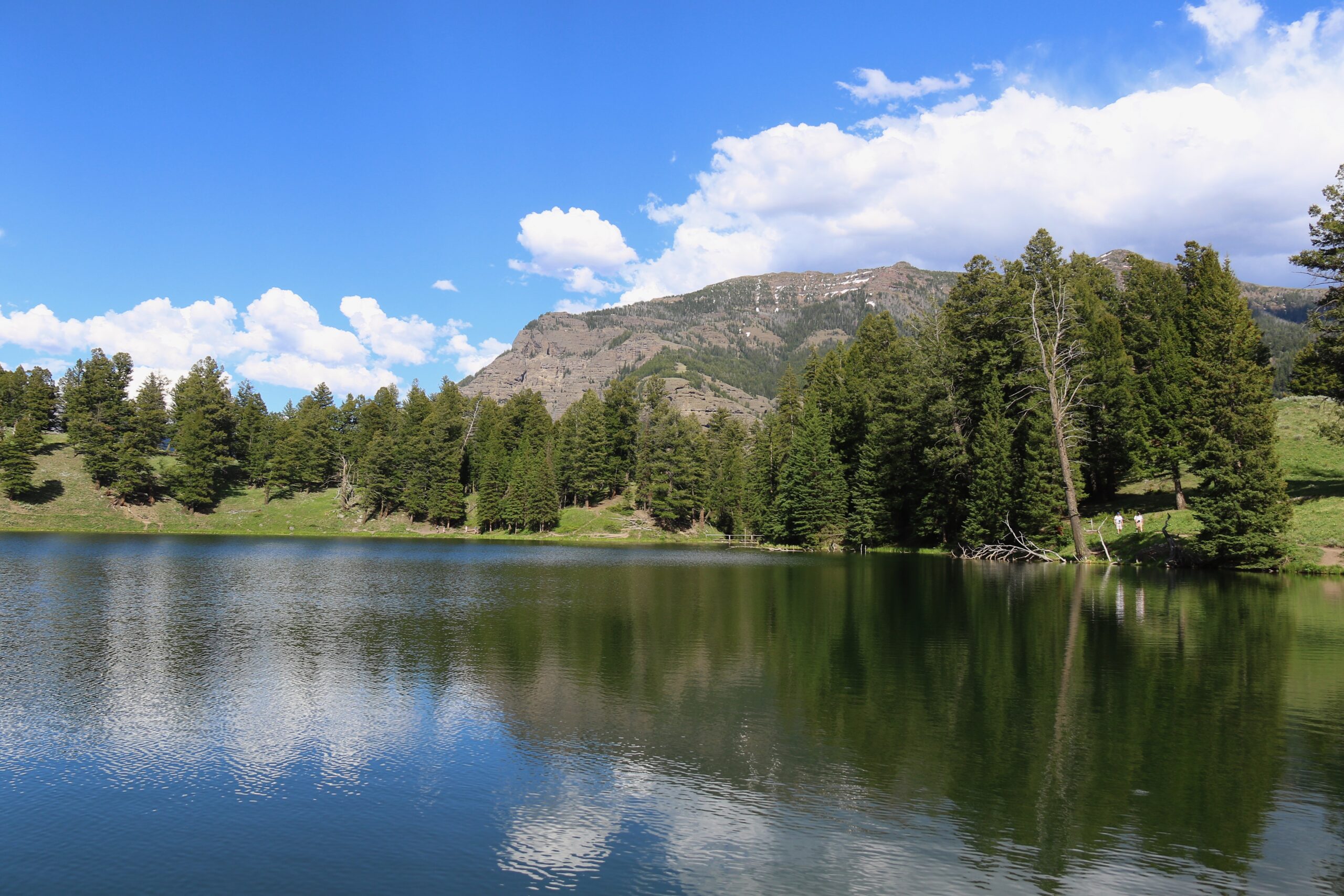
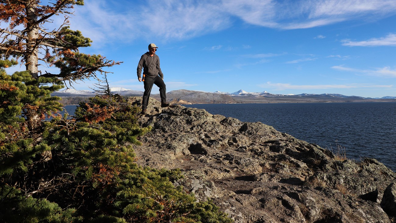
Trout Lake
Trout Lake is one of the many day hikes in Yellowstone National Park that is largely overlooked for many reasons. One is because the distance is so short (just a little over a mile round trip) that many hikers will not consider it for a day hike. Another is because it is located far from the other frequently visited areas of the park. It is also because the trailhead isn’t well signed as cars zip between the Northeast Entrance and Lamar Valley.
When you hike this trail, be aware that the first quarter mile is all uphill, gaining 300 feet. While not ideal, this is the only real hill on the trail and is quickly over with. Once you climb the hill and see the lake, follow the path down to the lake shore and begin your walk around. Make sure you do not just hike to the first viewpoint and then turn around. Like any lake, the best experience one can have is to circumnavigate it. I tend to circle the lake clockwise, as that direction offers the best views. However, there is no wrong way, just personal preferences. If you do head left, you’ll cross a small bridge, then trace the lakeshore.
Add More: On the far side of the lake, you can follow a boot path up the creek to another lake, though this trail is steep and not maintained.
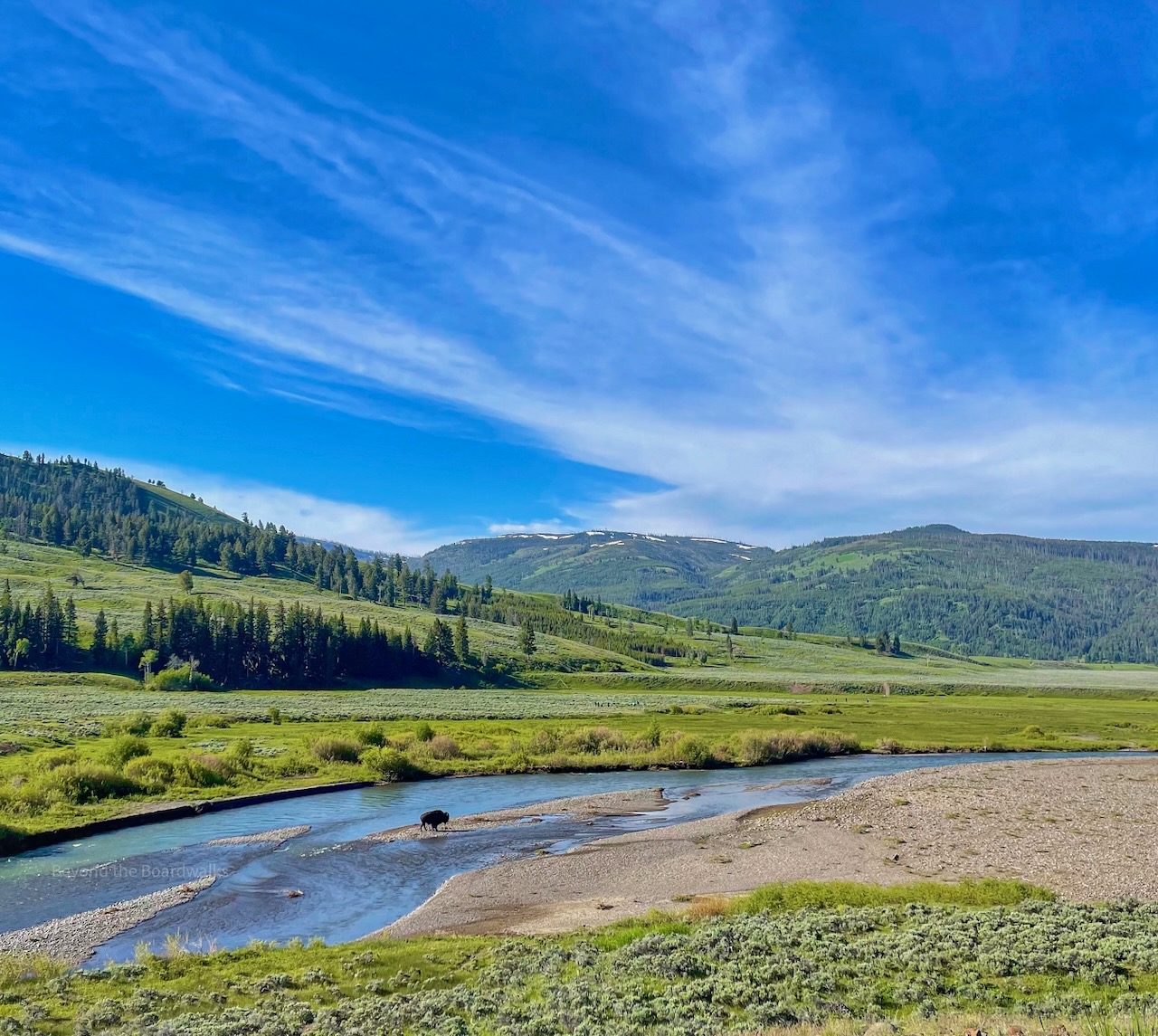
Lamar River Trail
Meandering along this mostly flat route, you’ll swiftly leave behind the rush of cars in the valley and immerse yourself in the park’s grandeur. While you can hike this trail for dozens of miles, the standard route is to hike the trail to the Lamar River and back, which is a little over four miles round trip.
As you approach the banks of the Lamar River, the sounds of nature emerge—birdsong fills the air, the river babbles and gurgles and the sounds of wildlife may find their way to your ears. Throughout spring, summer, and fall, fortunate hikers may catch glimpses of wolves, bears, moose, bison, pronghorn, and an array of avian species. In July and August especially, be aware that bison can and will block your trail at times.
Add More: Turn left at the Cache Creek Trail and head to the thermal area tucked away from view. It is a good place to scan for wildlife and really feel removed from the busyness of the roadway.
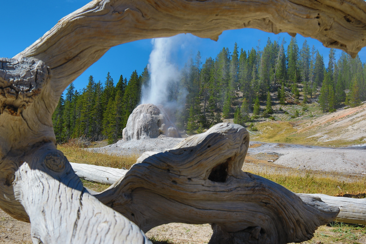
Lone Star Geyser
This is one of the easiest five-mile hikes you’ll find in Yellowstone. The route to Lone Star follows an old road that is flat and wide. Why hike such an easy road along the Firehole River? To see the geyser erupt. Lone Star Geyser erupts up to 45 feet from a 12-foot (3.6 m) cone approximately every three hours. Before heading out here, check in at the ranger station at Old Faithful to see if they have an updated schedule for the next eruption. Sometimes they do, sometimes they don’t.
If you do hike this, I strongly suggest making it a picnic day and expecting to stay for a bit. It is a scenic trail and one that I honestly do not visit enough. You’ll potentially encounter some wildlife out here on the trail, but mainly I would expect to see seasonal birds, a few bison, and maybe an elk or something. Anything else is extremely rare. Still carry bear spray, though.
Add More: You really can’t add more to this trail, but if you are hoping to watch another lesser-seen geyser erupt, check out Daisy Geyser near Old Faithful.
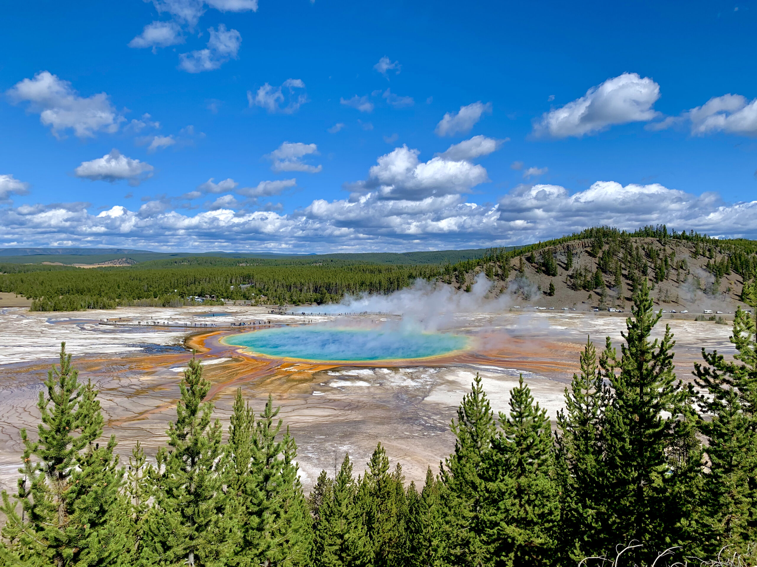
Grand Prismatic Overlook and Fairy Falls
This is probably the most well-known hike in Yellowstone National Park, and for good reason. Not only will you get a truly stunning view of Grand Prismatic Hot Springs, but you’ll also have a chance to walk to a scenic little waterfall that is hidden from view. You will have to hike a little under seven miles to reach both the overlook and the falls, but the trail is mostly flat and simple. Be aware that parking close to the trailhead can be a bit hard to find in the middle of the day.
The trail to the Grand Prismatic Overlook follows an old road for 0.65 miles before meeting the spur trail to the overlook on the left. Hike up the hill, gaining about 100 feet, to reach the viewpoint. After taking in the views, hike down the trail on the other side and continue on the road, away from the parking area. After another mile, you’ll reach the Fairy Falls Trail, which is reached in about 1.5 more miles.
Add More: Consider adding a few miles round trip from Fairy Falls by hiking out to Imperial Geyser. You’ll reach it by following a trail beyond the waterfall.
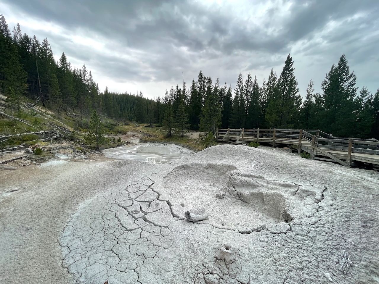
Artist Paint Pots
About one mile in length and gaining a little over 100 feet in total elevation, the Artist Paint Pots Trail is a lesser-seen thermal area between Norris and Madison Junction. The trail is a short loop (it is actually a lollipop, but few care about the slight difference) with cool thermal features and decent views. The mud pots here are awesome, especially in the spring and early summer, but start to dry out a little when the heat of the summer is in full force. Even then, this one is a personal favorite of mine when I want a super short and easy hike in a thermal area.
This trail is a great alternative to the busier boardwalk path at Fountain Paint Pots, though parking can also be an issue here, like at Fountain Paint Pots.
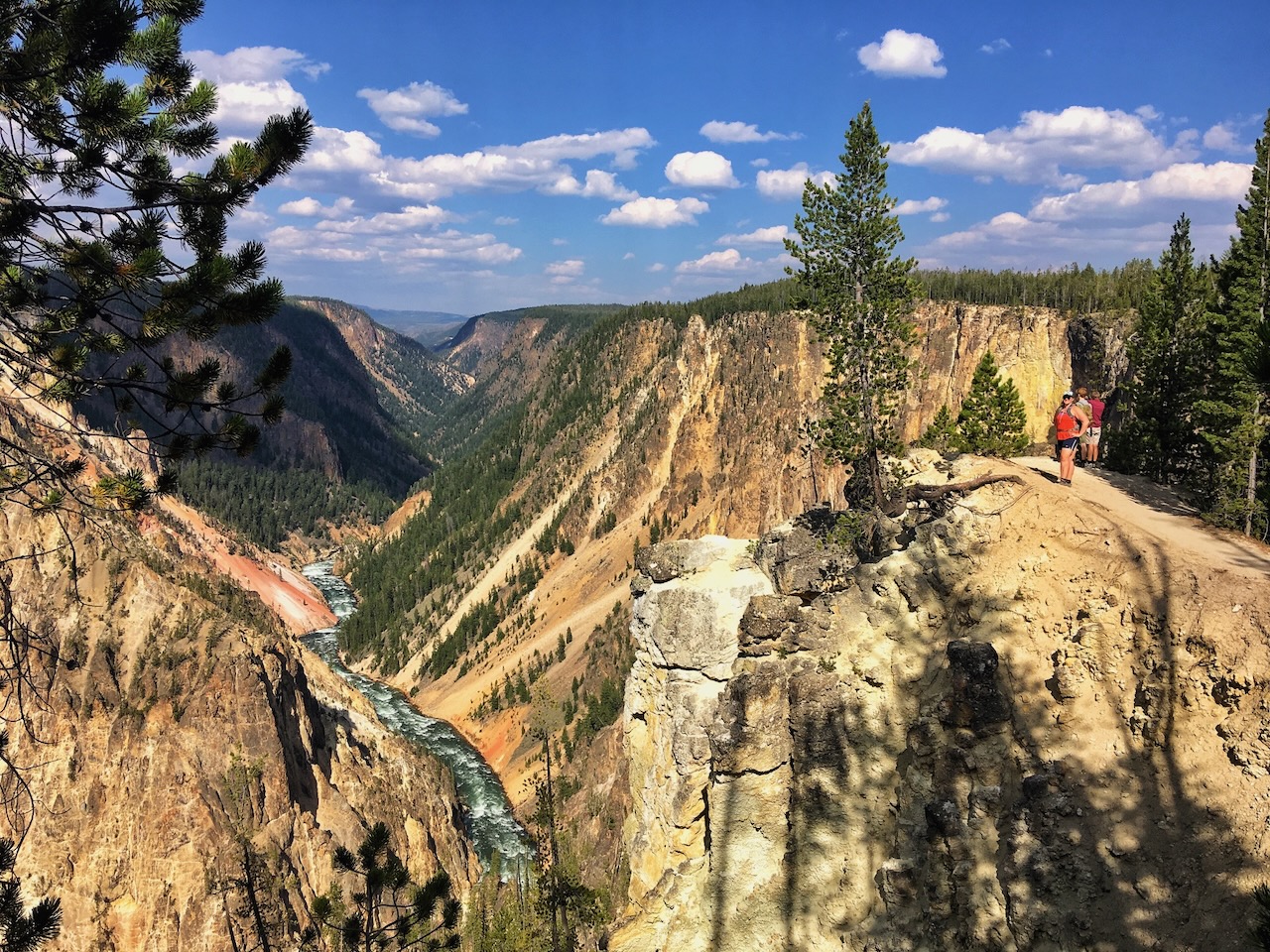
Point Sublime by Artist Point
This trail is a nice addition to a visit to Artist Point at the Grand Canyon of the Yellowstone River. Point Sublime is not exactly well-known in the park because the view does not live up to the name. To reach Point Sublime, it is a 3-mile round trip trek with 300 feet of elevation gain. Honestly, the view at the end isn’t worth it, as there are much better views that are easier to reach.
Instead, hike down the trail about half a mile for a truly spectacular view of the Grand Canyon of the Yellowstone River. You’ll know you have reached the spot when the trail skirts along the very rim of the canyon, almost precariously so. After taking in this view, you could walk a bit more along the canyon rim, or head back and find another short hike.
Add More: What are those? Consider hiking the short trails to the Brink of the Lower Falls and Red Rock Point on the North Rim. I also suggest walking the flat stretch between the Brink of the Upper Falls and the Bridge over South Rim Drive.
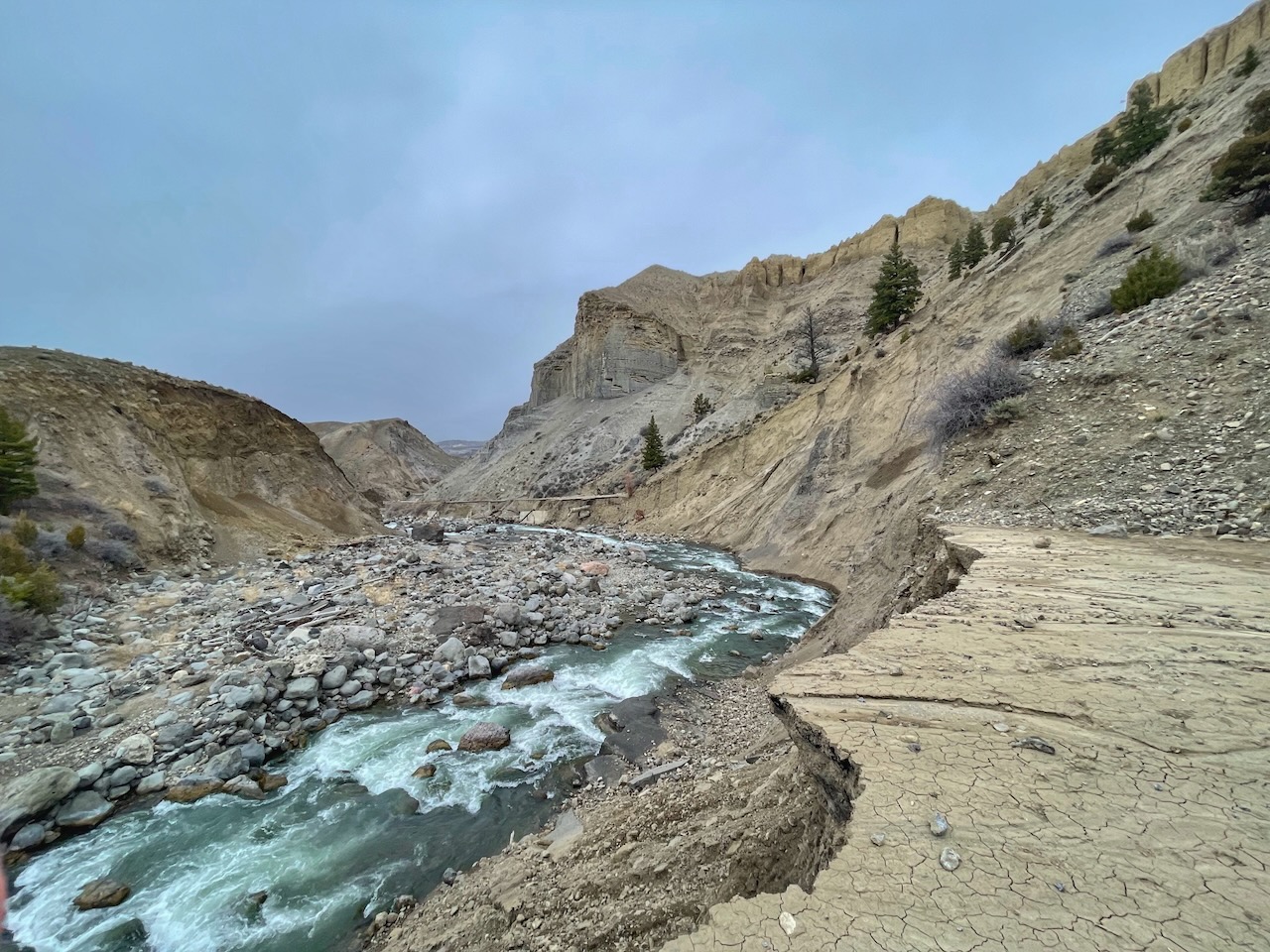
Mammoth to the Washout on the Old Road
Ok, this may not be the easiest trek, but it is all on a road and is a unique experience in the park. Starting at Mammoth, hike downhill along the road past the campground and continue on the old road as it travels north. The road meaders as it drops in elevation, reaching the old Boiling River parking area around mile two. After you cross the Gardner River, the road levels out a bit and you’ll enter an area where migratory birds hang out, including eagles and osprey. Soon, you’ll be walking next to steep canyon walls on one side, where bighorn sheep like to hang out, and along the Gardner River on the other. At around mile mark 2.7, you’ll reach the end of the road, where it washed away in the floods of 2022. The view here is quite dynamic.
Once you have taken in the sights, head back the way you can. Do not enter the Boiling River Area, even if you see others there. It is closed. The adventure will be 5.5 miles in total, with 700 feet of elevation gain. If you want a shorter version of this that is slightly less scenic, consider hiking the old road from Gardiner until the first or second washouts.
NEED EVEN MORE HIKING OPTIONS?
If you want even more of my favorite trails to the region, I have written a guidebook with over 50 hikes in and around Yellowstone. The stunning trails of the region are not limited to the park boundaries of Yellowstone National Park, which I cover well. My book also highlights spectacular hikes outside the park in the Absaroka-Beartooth Wilderness, the Bridger Range, and the Gallatin Mountains. Trust me when I say the hikes in my book will keep you enchanted on the trails for years.