This week in Yellowstone National Park, from July 17th through July 23rd, I share the news about a new thermal feature, tell you why you should visit Hayden Valley, teach you about Mission 66, and let you know of a great hike for this week. I will also give you the complete weather forecast, wildlife report, and everything else you need to have an incredible time, “This Week in Yellowstone.”
LISTEN TO THIS AS A PODCAST!
Apple: https://podcasts.apple.com/us/podcast/this-week-in-yellowstone-national-park/id1789397931
Spotify: https://open.spotify.com/show/41E5WWldz4s7n6NXh2Lahr
RSS: https://rss.com/podcasts/this-week-in-yellowstone-national-park/
Disclaimer: I might miss a few details, so feel free to reach out with questions! I also mention park locations casually—if you’re unfamiliar, a quick search can help.
Also, this podcast is a passion project—I’m not paid or sponsored. If you enjoy it, I’d love a review or a quick email! To support my work, check out my guidebooks on hiking and wildlife watching, or join me for a guided Yellowstone tour. For details, visit outdoor-society.com or reach out directly!
THIS WEEK’S YELLOWSTONE NEWS
A New Thermal Feature At Norris!
On April 10, 2025, geologists from Yellowstone National Park returned to Norris Geyser Basin for routine maintenance, their first visit since last fall. But what they found wasn’t routine at all.
In the Porcelain Basin, just west of a patch of trees called “Tree Island,” they discovered something new: a milky-blue thermal pool that hadn’t been there the year before.
The pool was about 4 meters (13 feet) wide, with warm water around 43 °C (109 °F), sitting 30 centimeters below the rim. Around it were scattered rocks coated in fine, light-gray mud. Two layers showed on the pool’s side, though the lower one was likely just a residue from when the water was higher.
All signs pointed to a hydrothermal explosion.
That might sound dramatic, but Norris Geyser Basin is no stranger to these events. Some are ancient, while others, like the Porkchop Geyser explosion in 1989, were well documented. Thanks to a monitoring station added in 2023, scientists can now detect explosions using infrasound and seismic data.
The new station experienced a significant explosion in April 2024. But for this newly discovered pool, satellite imagery tells a quieter story.
High-resolution images show no feature near Tree Island on December 19, 2024. By January 6, 2025, a shallow depression had formed, and by February 13, the pool was fully developed. Infrasound data recorded weak acoustic signals on December 25, January 15, and February 11, but none strong enough to indicate a major blast.
All signs suggest the feature formed gradually, through several small outbursts. Rocks were ejected first, followed by silica-rich mud, creating a pit that filled with blue water.
This new pool is a powerful reminder of Yellowstone’s ever-changing nature. In Norris Geyser Basin, perhaps the park’s most dynamic area, some features erupt into existence, while others, like this one, slowly take shape over time.
No, Animals Are Not Fleeing Yellowstone
There are a lot of dumb things on the internet, and every so often, the stupidity is about Yellowstone. Usually, the posts are about an imminent eruption of the park. This time, there are numerous social media reports about wildlife fleeing Yellowstone. The videos they use show bison herds and elk herds moving around, and claim, inaccurately, that this is proof that animals are predicting something in the park.
What makes this the worst is that the initial posts are done tongue-in-cheek, but like most things online, some fail to see obvious jokes. They report it as truth, and then it creeps into everything. The reason I am even mentioning it is that I was asked about it in the park by two different groups of people. Again, animals are not fleeing the park. Everything is normal. Someone created posts for fun, and people are believing them.
Late News For This Webpost Only
I’ll cover this next week on the podcast, but a food-conditioned black bear was just killed in the park. Story here: https://outdoor-society.com/yellowstone-euthanizes-food-conditioned-black-bear-after-backcountry-incidents/
EXPERIENCE OF THE WEEK
Hayden Valley
A visit to Yellowstone’s Hayden Valley offers some of the most iconic wildlife viewing and scenery in the entire park. That is why I am recommending it this week. Starting from the north end near Canyon and ending at LeHardy’s Rapids, spending a morning or an evening here gives you a perfect Yellowstone experience. I am saying to come here in the morning or evening, because during the day, it will potentially be crowded due to the bison herds snarling traffic and generally causing all sorts of commotion.
While one could spend all day in and around Hayden Valley with ease, most people who visit the park only have a half day for the area, so I am giving you my highlights. Also, I am assuming you have already wandered around the canyon area, so I am not mentioning that here. If you have Canyon-specific questions, feel free to reach out to me.
Just south of Canyon, the road runs parallel to the Yellowstone River, giving you great views of the calm river before it reaches the waterfalls nearby. On this first stretch of road, a stop at the Otter Creek picnic area is a nice place to have some river time, and maybe catch a glimpse of some birds or other wildlife. However, this isn’t technically Hayden, so keep heading south, and soon you will leave the trees behind.
The true start of Hayden Valley is found at the twin pullouts near the Mary Mountain Trailhead. To the east in the Yellowstone River, to the south and west, you’ll get a wide view of Hayden Valley. For those hoping for a hike, the Mary Mountain Trail is a good option. While it does run for 20.2 miles in one direction, ending all the way over at the geyser basins, you can just hike a little of it and quickly feel like you are in the wilds of the park. Bring bear spray, water, bug spray, and all of your hiking gear, even if you only hike a mile out. If you’d rather not hike, consider going to the other side of the road and scanning for wildlife and birds around the Yellowstone River. Don’t worry if you don’t see anything. This is just the start.
Continuing south on the Grand Loop Road, the landscape quickly opens into the heart of Hayden Valley, a roughly 7-mile by 7-mile vast expanse of sagebrush, grassland, and the winding Yellowstone River. Keep your eyes peeled for wildlife as you drive through this area. Numerous roadside pullouts, many of them unsigned, offer great spots to stop and scan for elk, coyotes, bald eagles, and even grizzly bears or wolves. Chances are, even around sunrise, you won’t be the only one out here, so also look for numerous cars at pullouts and people on spotting scopes and binoculars, as they might be looking at animals.
Right now, you’ll also more than likely encounter huge herds of bison in and around the road in Hayden Valley. They are in their rut, mating season, and are active. It is another reason I am saying to go here right now. The bison rut will cause traffic delays, so be ready for that.
One particularly worthwhile stop is Grizzly Overlook, where the valley views are especially panoramic and where predator sightings are most common. This is also one of the most iconic viewpoints in Hayden, so stay here a bit and enjoy it. While you should have your binoculars or a spotting scope ready at all times in Hayden, definitely take them out here. I have often seen elk, bison, bears, wolves, and all sorts of bird species from here.
Beyond the Grizzly Overlook, there are a few more pullouts that are great areas to stop and take in the view, watch for wildlife, or just sit back and have some calm. You’ll also notice that when you reach these last few pullouts, the trees start to become more common. This is technically the end of the valley, but keep going. In a little bit, you’ll reach the Mud Volcano area. Stop here and take a short walk on the Mud Volcano boardwalk loop, where you can see bubbling mud pots, hissing steam vents, and the dramatic Dragon’s Mouth Spring. The area also has restrooms and a large parking area, making it a practical stop, as well as a scenic one.
Finish your day with a stop at the LeHardy Rapids Picnic Area, just before reaching the Fishing Bridge region. Here, you can walk down to the river to watch the Yellowstone River rush through basalt rapids, a great place to observe trout and enjoy the cool mist from the water. The area has picnic tables, restrooms, and easy river access.
TIP OF THE WEEK
Consider Skipping the Wraith Falls Trail
I try to remain as positive as possible with this podcast, and I try to inspire. I work hard to always encourage visitors to the park to follow what interests them and to ignore naysayers. Which is why I understand that the following section will seem a bit hypocritical. However, instead of just badmouthing a trail and ending the segment, I am also going to be recommending better options to ensure you have a good time.
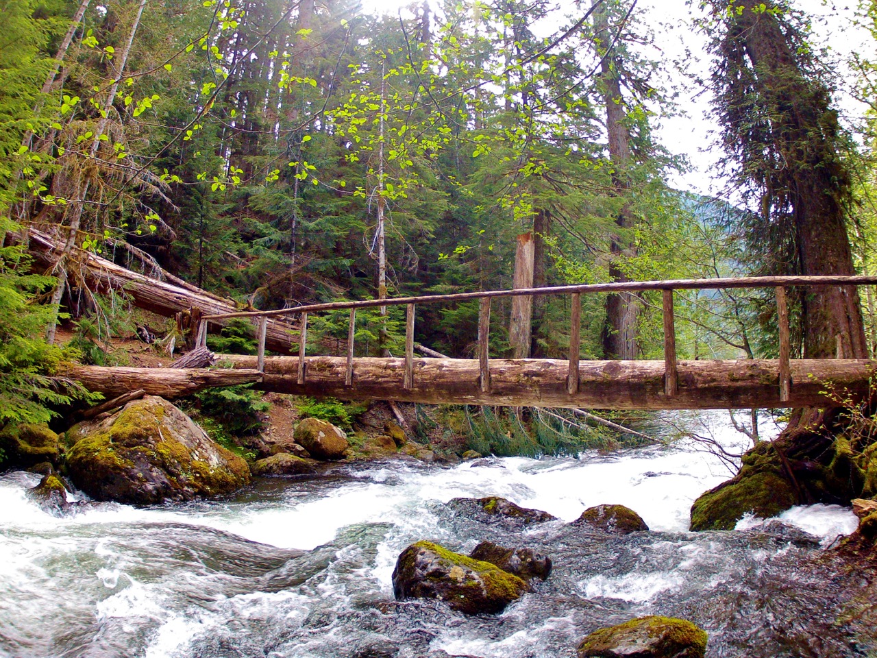
I am in the northern range a lot, and I often drive by a trailhead where I see plenty of people hiking. It is a trail I have done numerous times, and while it is pretty enough, it is a hike that the majority of people I talk to consider to be disappointing. That hike? Wraith Falls. Located just over five miles from Mammoth, Wraith Falls is a one-mile round-trip hike that is a mostly flat, easy trail that leads to a waterfall. In the spring, the waterfall can be flowing quite well, but by the time summer rolls around, the waterfall is a trickle. Even at its best flow, the waterfall is about a quarter-mile from the end of the trail, leaving a lot to be desired.
Some do love this trail, and for those of you who do, more power to you. It is considered a classic hike in the park, and occasionally has some fantastic wildlife opportunities. If you have never seen a waterfall while hiking before, this is a nice start, but there are way better, easier trails to get a more spectacular waterfall view. Also, I understand that some trails are not easy for kids, but a lot of the waterfall trails are family-friendly. I, in no way, shape, or form, am telling you to never hike the Wriath Falls Trail. I am just letting you know that an alternative exists; if you want a truly special trail that delivers a lot more in the way of views and experiences, there is one just a few miles away.
Instead of hiking Wraith Falls, consider hiking the top part of the Lava Creek Trail, starting near the Lava Creek Picnic Area. Lava Creek Trail is a much longer trail for intrepid hikers, but those looking for an easy, family-friendly trail should consider hiking the top section of the trail. The top section of this hike is only about a mile round trip, mostly flat, and will lead you to a much more spectacular waterfall view of Undine Falls, as well as a cliffside view of Mammoth Hot Springs way off in the distance. This isn’t the Undine Falls view you see from the paved parking area next to the road. By hiking here, you get to stand on top of the waterfall and be out in nature. Trust me, this is a much better hike. It is also family-friendly, but be extremely careful along the cliff edges, as the fall here can be fatal. Also, like every trail in the park, including Wraith Falls, always carry bear spray, have it quickly accessible, and know how to use it.
To hike to the top of Undine Falls, park at the Lava Creek Picnic Area. Once parked and packed up to hike, walk across the bridge and cross the main road. There is a small boot path on the northeast side of the bridge that, if followed, leads to a wide, easy-to-follow trail, complete with a trail sign.
RANDOM YELLOWSTONE FACT OF THE WEEK
How Mission 66 Modernized Yellowstone and Shaped the Park Experience You Know Today
By the early 1950s, America’s national parks were in serious decline, just as public interest was soaring. In 1945, about 11.7 million people visited national parks. By 1954, that number had quadrupled to nearly 48 million. Yet the infrastructure, roads, restrooms, and water lines were falling apart. Years of underfunding, especially during World War II when staffing and budgets were slashed in half, had taken a major toll. Even after the war, park facilities continued to deteriorate while crowds kept growing.
Sound familiar?
Public concern followed. Writer Bernard DeVoto described the condition of the parks as “nationally disgraceful,” and longtime park supporter John D. Rockefeller Jr. called it a “national tragedy.” Faced with this growing crisis, National Park Service Director Conrad Wirth championed a bold idea: a major investment in modernizing the parks, not restricting access. He believed national parks were essential to American life and public well-being.
This vision became Mission 66, a $1 billion, ten-year effort named for its 1966 target, coinciding with the Park Service’s 50th anniversary. Wirth and his team developed the plan quickly and quietly, even choosing a name with a military ring to emphasize its urgency. The goal was to improve roads, build new visitor centers, upgrade utilities, and create a park system that could meet the needs of a new generation of car-bound travelers.
Congress approved funding in 1956, and Mission 66 officially launched. Yellowstone became a major focus, especially with the complete redesign of Canyon Village. The grand old Canyon Hotel, built in the early 1900s, was torn down and replaced with the car-friendly Canyon Lodge complex we see today. The new layout, with visitor services spread out and surrounded by large parking areas, reflected the postwar shift from train travel to automobile tourism.
Mission 66 also reshaped how Yellowstone worked on the ground. The Canyon Visitor Center, originally built during this era and now updated as the Canyon Visitor Education Center, showcased modernist architecture with big windows and clean lines, quite different from the rustic “Parkitecture” of earlier years. Campgrounds, comfort stations, and employee housing were also rebuilt, and many sections of the Grand Loop Road were redesigned to better accommodate vehicles.
So, the next time you walk into Canyon Village or drive a smooth stretch of road through Yellowstone, you’re not just enjoying modern comforts, you’re seeing the legacy of Mission 66. This ambitious program didn’t just modernize the park; it redefined how we experience it, balancing access with preservation and helping shape Yellowstone into the park we know today.
SNOWPACK UPDATE
Not in this week’s episode. This will be back in October, probably.
ROADS CONDITIONS
All major roads and most side roads are open right now in and around Yellowstone National Park. This includes Dunraven Pass and the Beartooth Highway.
For up-to-date information, call (307) 344-2117 for recorded information, or sign up to receive Yellowstone road alerts on your mobile phone by texting “82190” to 888-777.
CAMPING INFO
Every campground in the park that is going to open this year is open. Pretty much all of them are full and have no opportunities to get a campsite if you don’t already have a reservation.
WILDLIFE WATCHING UPDATE
You have to listen to the podcast to get this information. Sorry.
Apple: https://podcasts.apple.com/us/podcast/this-week-in-yellowstone-national-park/id1789397931
Spotify: https://open.spotify.com/show/41E5WWldz4s7n6NXh2Lahr
RSS: https://rss.com/podcasts/this-week-in-yellowstone-national-park/
PICK UP A GUIDEBOOK
Love what you have heard on this podcast and want more information on wildlife watching? Get a copy of my wildlife-watching guidebook to the region! Available in both ebook and paperback formats, my book will help you spot wildlife like a seasoned local. Please consider buying a book directly from me, as I make nothing when they are sold on Amazon. Grab your copy now at outdoor-society.com!
TRAIL ALERTS AND UPDATES
Currently, as of the time of this recording, all trails that are supposed to be open in the park are open. Trails in the bear management areas are not included in that statement. All the information on trail conditions can be found on the Backcountry Conditions Page of Yellowstone National Park.
TREK OF THE WEEK
This week, I am recommending you plan a hike at the Grand Canyon of the Yellowstone. While the area is popular, it is that way for a reason. It is stunning, scenic, and sure to dazzle you numerous times. Sure, there are some paved sections of the hike, but that doesn’t make it any less spectacular.
The scenic trail follows the stunning North Rim of the Grand Canyon of the Yellowstone, offering plenty of opportunities to take in breathtaking views from several side trails that lead to overlooks and the brink of both major waterfalls. It begins on the north side of the Chittenden Bridge, following the Yellowstone River downstream along an easy, wide path that used to be an old road. Early on, you’ll cross the beautiful Canyon Bridge before reaching the first spur trail, which takes you down a set of stairs to the brink of the thundering Upper Falls. From this vantage point, right above the 109-foot (33-meter) drop, you can feel the power of the water beneath your feet.
Continuing along the North Rim Trail, you’ll pass by the Upper Falls parking area and briefly follow the road until you see a sign marking the continuation of the dirt trail. Not far along, a short spur leads you to a lovely overlook of Crystal Falls. Afterward, the main trail crosses Cascade Creek just above the falls, offering a couple more views of the river below and a chance to look back at the Upper Falls.
Next comes one of the highlights, the Brink of the Lower Falls Trail. This section begins with a paved path that snakes dramatically down through nine tight switchbacks. The descent is relatively short but steep, so take your time, especially on the way back up. As you near the bottom, the roar of the water grows louder, and then suddenly you’re at the edge, standing just feet from where the Yellowstone River spills over the cliff, plunging 308 feet (94 meters) into the heart of the canyon. The view is raw and intense. Mist rises up from below, and you can see the river twist and carve its way through layers of vividly colored rock. It’s a place where the sheer force of nature is on full display, and it’s not uncommon for visitors to be awestruck by the magnitude of the drop and the thunderous sound. This close encounter with Lower Falls is one of the most unforgettable experiences in the park.
After climbing back up, continue along the North Rim Trail on a paved section that runs beside a parking lot, where you’ll find numerous overlooks with stunning views of the canyon’s colorful cliffs.
As the trail dips back into the trees on a dirt path, you’ll catch glimpses of the canyon on your way to Lookout Point. From there, a paved path and another parking area give you easy access to this excellent viewpoint. Don’t miss the Red Rock Point Trail here; it’s one of the most dramatic short hikes in the area. The trail drops almost 300 feet (90 meters) via steep switchbacks and stairs carved into the cliffside, cutting through sheer rock walls with occasional railings for support. The descent gives you ever-evolving views of the canyon until it culminates at Red Rock Point, where you’re rewarded with a face-on, elevated view of Lower Falls. It’s arguably one of the best photo spots in the park, offering a direct and unobstructed view of the falls pounding into the canyon below. The color of the surrounding rock, the swirling mists, and the sound of the crashing water make this an utterly immersive experience. The hike back up is a bit of a workout, but it’s absolutely worth it for the perspective you gain at the bottom.
From Lookout Point to Grand View, the paved path hugs the canyon’s edge, offering one awe-inspiring view after another. The yellow, craggy rock formations rise like ghostly towers while the river roars below. Grand View provides more spectacular scenery and a glimpse across the canyon to Artist Point. From here, the trail returns to a dirt path, winding through the forest with occasional views of the canyon until you reach Inspiration Point and its nearby parking area. This is a good spot to turn around unless you’ve arranged for a car shuttle, in which case you can complete the hike as a one-way journey totaling around 5 miles, including the spur trails.
To start this adventure, I like to park at the signed Wapiti Lake parking lot on the South Rim Drive, just east of Chittenden Bridge near Canyon Village. From there, follow the paved path in the northwest corner of the lot down to the bridge and cross to the North Rim Trail trailhead. Expect about 1,100 feet) of elevation gain, and the same in descent, along the way.
NEXT WEEK
In next week’s episode, I’ll return with all of the information you need to have a good week in the park, including wildlife, weather, and trail updates.
Until then, happy trails!