 by
by 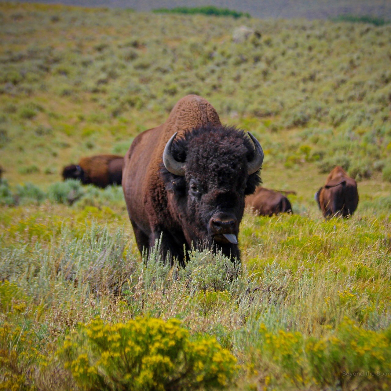
This week in Yellowstone National Park, from July 23rd to July 29th, 2026, I dive into the Hayden vs Lamar debate, let you know why viewing the park as two main driving loops is somewhat flawed, and share with you the smelliest geyser basins. I will also give you the complete weather forecast, a cool trail to hike, the snowpack update, the wildlife report, and everything else you need to have an incredible time, “This Week in Yellowstone.”
LISTEN TO THIS AS A PODCAST
The text below is my notes for the podcast. They may be incomplete.
Apple: https://podcasts.apple.com/us/podcast/this-week-in-yellowstone-national-park/id1789397931
Spotify: https://open.spotify.com/show/41E5WWldz4s7n6NXh2Lahr
RSS: https://rss.com/podcasts/this-week-in-yellowstone-national-park/
Disclaimer: I may miss a few details, so please feel free to reach out with any questions. I also mention park locations casually. If you’re unfamiliar, a quick search can help. This report only covers drivable areas of the park.
Also, this podcast is a passion project. If you enjoy it, I’d love a review or a quick email! To support my work, check out my hiking and wildlife-watching guidebooks, or join me for a guided hiking tour in Yellowstone’s backcountry. For more information, visit outdoor-society.com or contact me directly. Seriously though, come book a trail tour with me.
THIS WEEK’S YELLOWSTONE NEWS
Grizzly Bear News
The debate over delisting grizzly bears in the Rocky Mountains has intensified again in 2026, although the bears have not yet been removed from federal protection under the Endangered Species Act. On July 14, 2026, the U.S. Department of the Interior announced a revised proposal that would give states and tribes greater flexibility to manage conflicts with grizzly bears while maintaining the species’ current threatened status. Interior Secretary Doug Burgum described the proposal as a step toward returning more wildlife management authority to western states, but emphasized that it does not delist grizzlies or immediately change existing protections.
The proposal follows a January 2025 decision by the U.S. Fish and Wildlife Service to deny petitions from Montana and Wyoming seeking to delist grizzly bears in the Greater Yellowstone and Northern Continental Divide ecosystems. Instead, the agency proposed managing grizzlies as a single lower-48 population while retaining federal protections and allowing limited additional flexibility for responding to conflicts with livestock and human safety.
A final decision has also been delayed. The U.S. Fish and Wildlife Service extended its deadline for completing the rulemaking until December 2026, meaning grizzly bears across the Northern Rockies remain federally listed as threatened while the agency reviews public comments and evaluates its final approach.
Supporters of greater state management argue that grizzly populations around Yellowstone and Glacier have recovered biologically and should be managed by state wildlife agencies. Conservation organizations counter that continued federal protection is necessary to promote long-term genetic connectivity between bear populations and ensure recovery across a broader portion of the species’ historic range.
Osprey Falls Closure
EXPERIENCE OF THE WEEK
Hayden vs Lamar
One of my favorite questions to ask visitors is whether they prefer Hayden Valley or Lamar Valley. Few Yellowstone debates spark stronger opinions. Almost everyone has a favorite, even though there is no right answer. Each valley offers something the other cannot, and the better choice depends entirely on the kind of Yellowstone experience you are hoping to have.
If wildlife is your priority, both valleys deliver, just in different ways. Hayden Valley, between Canyon Village and Fishing Bridge, comes alive in mid-July as the bison rut gets underway. Massive herds gather across the valley floor while mature bulls bellow, wallow, spar, and compete for breeding opportunities. Elk are common, coyotes regularly hunt the meadows, and both grizzly and black bears still make occasional appearances, especially during the cooler morning hours before many move to higher elevations later in summer. Hayden has also featured a highly visible wolf pack during the past few summers, making it an exciting place to spend time.
Lamar Valley tells a different wildlife story. Known as America’s Serengeti, it is famous for its incredible variety of mammals. Bison, pronghorn, mule deer, elk, bighorn sheep, coyotes, and even badgers are all regularly seen here. Lamar is also Yellowstone’s premier wolf-watching destination. While wolves are easier to spot in winter, patient visitors with spotting scopes still have opportunities to watch packs traveling the valley or tending pups near summer rendezvous sites during the early morning. If your dream is watching predators across a distant hillside, Lamar is hard to beat. That said, many people insist Hayden is the better place to experience the bison rut. This year, though, Lamar has been every bit as impressive, with thousands of bison visible, many actively participating in rut behaviors. It is honestly neck and neck.
The scenery offers another contrast. Hayden Valley feels like classic Yellowstone. The Yellowstone River winds through broad wetlands, forests, and meadows, with distant mountain ridges framing the landscape. Steam from nearby thermal features often drifts across the valley, reminding visitors that one of the world’s largest volcanic systems lies beneath their feet. At sunrise, mist rising from the river creates incredible opportunities for wildlife photography.
Lamar Valley feels bigger and wilder. Sweeping grasslands stretch beneath rugged mountains, with the Lamar River winding through the valley below. Colorful sagebrush benches and endless mountain backdrops explain why so many wildlife documentaries have been filmed here. Even on quieter wildlife days, the scenery alone is worth the visit.
The surrounding attractions also set the valleys apart. Hayden sits in the heart of Yellowstone’s busiest sightseeing corridor. Within minutes you can reach the Grand Canyon of the Yellowstone, Artist Point, Lookout Point, the Upper and Lower Falls, Mud Volcano, Dragon’s Mouth Spring, and Yellowstone Lake, making it easy to combine wildlife viewing with many of the park’s most iconic destinations.
Lamar rewards those willing to venture farther from the crowds. Tower Fall lies nearby, along with the historic Lamar Buffalo Ranch. Continue east to the Northeast Entrance and you’ll reach Cooke City and the spectacular Beartooth Highway, making Lamar an excellent starting point for exploring Yellowstone’s northeastern corner.
Crowds are another consideration. Hayden’s central location makes it one of the park’s busiest wildlife-viewing areas, and traffic jams are common when bears or wolves appear near the road. Lamar certainly gets busy too, but its larger pullouts and more remote setting often make it feel less congested once you move beyond the main viewing areas.
Timing matters no matter which valley you choose. Wildlife is most active during the first few hours after sunrise and again before sunset. Midday can still produce memorable sightings, especially during the bison rut, but cooler temperatures generally bring more activity. Early mornings also mean softer light for photography, fewer vehicles, and a greater sense of solitude.
So which valley wins in mid-July? If you want the excitement of the bison rut, Yellowstone’s famous waterfalls, and easy access to thermal features, Hayden Valley is tough to beat. If you would rather search for wolves, soak in expansive mountain scenery, and combine your visit with Tower Fall, Cooke City, or the Beartooth Highway, Lamar may be your favorite.
The real answer, though, is not choosing one over the other. Give each valley a sunrise of its own. Together, Hayden and Lamar showcase two very different sides of Yellowstone, and experiencing both is one of the best ways to appreciate what makes the park so extraordinary.
TIP OF THE WEEK
The Problem With Only Planning Your Trip Around the Loop Drives
If you’ve started planning a Yellowstone vacation, you’ve almost certainly come across the same advice: spend one day driving the Lower Loop and another driving the Upper Loop. It sounds like a simple, foolproof plan. Since Yellowstone’s roads form a giant figure eight, dividing the park into two loops seems like the easiest way to see everything.
There is absolutely nothing wrong with that advice, especially if you’re visiting for the first time or only have a couple of days. It’s a great starting point. The problem is that many visitors stop there, thinking of Yellowstone as two loops instead of a collection of remarkable landscapes connected by one road system. That small shift in perspective can completely change your trip.
One of the biggest surprises for first-time visitors is just how enormous Yellowstone really is. At more than 2.2 million acres, the park covers nearly 3,500 square miles, making it about the same size as Puerto Rico. Once you’re here, the distances become obvious. A drive that looks short on a map can take hours thanks to winding roads, wildlife delays, construction, and countless places you’ll want to stop. A drive that looks like two hours can easily become four once you stop for bison, a roadside grizzly, or a beautiful viewpoint. Planning your day around completing an entire loop often means spending more time driving than experiencing the park.
The real issue is that Yellowstone isn’t organized around its roads. It’s organized around ecosystems, watersheds, geothermal basins, mountain ranges, wildlife habitat, and historic districts. The Grand Loop Road simply connects them. When your goal becomes finishing a loop, it’s easy to spend more time commuting between destinations than enjoying them.
Take the Upper Loop as an example. Driving from Mammoth Hot Springs to Tower-Roosevelt, through Lamar Valley, to Canyon Village, and back to Mammoth looks reasonable on a map. In reality, it can easily fill an entire day, leaving you watching the clock instead of the wildlife.
Lamar Valley often suffers because of this. Nicknamed America’s Serengeti, it is one of North America’s premier wildlife destinations, home to wolves, grizzly bears, black bears, bison, pronghorn, elk, bighorn sheep, coyotes, foxes, and countless birds. The National Park Service recommends visiting at sunrise or sunset, when wildlife is most active. Yet many people following an Upper Loop itinerary don’t arrive until late morning after spending hours at Mammoth or Tower Fall, passing through one of Yellowstone’s best wildlife areas during its quietest hours.
Fishing Bridge is another place that’s easy to overlook. Many visitors simply pass through on their way to Hayden Valley or Yellowstone Lake, but it serves as the gateway to an entirely different side of the park. Here you can visit the Fishing Bridge Visitor Center, explore the Lake Village Historic District, walk along the lakeshore, or watch white pelicans, trumpeter swans, ospreys, and bald eagles. It also marks the beginning of the scenic East Entrance Road.
The drive toward Sylvan Pass is one of Yellowstone’s most underrated experiences. As the road climbs above Yellowstone Lake, lodgepole forests give way to sweeping mountain views before descending through the rugged Absaroka Range toward Cody, Wyoming. Dramatic overlooks, alpine scenery, and colorful volcanic rock line the route, yet many visitors never see it because it doesn’t fit neatly into a loop itinerary.
Yellowstone Lake is often treated the same way. Many people admire it through the windshield before continuing to Old Faithful or Canyon Village. Yet the lake covers more than 130 square miles, making it North America’s largest high-elevation lake. Peaceful shoreline walks, scenic overlooks, picnic areas, historic lodges, and hikes like Storm Point reveal a quieter side of Yellowstone that is easy to miss when you’re racing to the next stop.
Mammoth Hot Springs deserves more time, too. Many visitors tour the Lower Terraces, take a few photos, and leave. What they miss is the historic Fort Yellowstone district, the Albright Visitor Center, beautifully preserved officers’ homes, elk wandering through town, nearby trails, and the Upper Terraces, all of which can easily fill half a day.
Instead of planning by loops, consider planning by regions. Give Hayden Valley the sunrise it deserves before exploring Mud Volcano and the Grand Canyon of the Yellowstone. Dedicate another day to the geyser basins around Old Faithful, Biscuit Basin, Black Sand Basin, and the Lower Geyser Basin, with time to walk the boardwalks or hike to Lone Star Geyser or Fairy Falls.
Spend another day enjoying Yellowstone Lake, Fishing Bridge, and the East Entrance Road. Explore Mammoth Hot Springs and the Golden Gate area, then finish with an evening in Lamar Valley. You’ll spend less time rushing between destinations and more time outside your vehicle.
Planning by region also makes Yellowstone’s unpredictability much less stressful. Wildlife doesn’t follow an itinerary. Neither do afternoon thunderstorms, road construction, or the bison jam that lasts 45 minutes because a herd decides the pavement is the perfect place for a stroll. When your day focuses on one part of the park instead of completing a loop, those surprises stop feeling like delays and become some of the best memories of your trip.
It also helps you appreciate that Yellowstone’s attractions aren’t isolated destinations. The geyser basins tell the story of the Yellowstone Volcano. Hayden Valley reveals the importance of rivers, wetlands, and wildlife. Yellowstone Lake showcases the immense caldera, while Lamar Valley highlights one of the world’s most intact temperate ecosystems. Spending meaningful time in each region helps those stories come together.
The Grand Loop Road is one of America’s great scenic drives, and there’s nothing wrong with using it as your guide. Just don’t let it become your destination. Plan around experiences instead of roads, and Yellowstone becomes much more than a giant driving tour.
RANDOM YELLOWSTONE FACT OF THE WEEK
The Smelliest Thermal Areas
One of the first things many visitors notice when they step onto a Yellowstone boardwalk is not the scenery. It is the smell. That unmistakable rotten egg odor drifts through parts of the park, sometimes faintly and sometimes strong enough to make people wrinkle their noses. While it may not be the fragrance most people hope to remember from vacation, it is a sign that Yellowstone’s volcanic heart is hard at work beneath your feet.
The smell comes primarily from hydrogen sulfide, a naturally occurring volcanic gas released by many of Yellowstone’s hydrothermal features. As the gas rises from deep underground, specialized microorganisms use it as an energy source. In acidic thermal areas, they convert hydrogen sulfide into sulfuric acid, which breaks down surrounding rock into clay and creates Yellowstone’s bubbling mudpots. Hydrogen sulfide produces the familiar rotten egg smell, while sulfuric acid helps shape many of the park’s colorful, ever-changing thermal features.
If one place consistently earns the title of Yellowstone’s smelliest destination, it is the Mud Volcano Area between Hayden Valley and Yellowstone Lake. The National Park Service describes this area as home to some of the park’s most acidic hydrothermal features. Boiling mudpots, steaming vents, and acidic pools constantly release sulfur-rich gases into the air. The bubbling Mud Volcano is fascinating to watch, while nearby Dragon’s Mouth Spring roars like distant thunder as steam rushes through an underground chamber. The combination of sound, steam, and sulfur makes this one of Yellowstone’s most memorable stops.
Just across the parking area sits Sulphur Caldron. Despite its name, it is an intensely acidic hot spring rather than a mudpot. With a pH between about 1 and 2, its water rivals battery acid. Constant releases of hydrogen sulfide give it one of the strongest sulfur odors in the park, especially when the wind shifts toward the boardwalk.
Norris Geyser Basin is another hotspot for sulfur smells. Yellowstone’s hottest and most dynamic thermal basin is filled with fumaroles, acidic pools, steaming ground, and constantly changing hydrothermal activity. Fumaroles, or steam vents, release volcanic gases directly into the air, often creating particularly strong odors. Walking through Norris on a cool morning, surrounded by thick clouds of steam, can feel like visiting another planet.
Some of Yellowstone’s smelliest thermal areas require leaving the roadside behind. Washburn Hot Springs is an excellent example, with steaming vents, bubbling mudpots, acidic pools, and fumaroles spread across a forested hillside. With few visitors and little breeze beneath the trees, the smell of hydrogen sulfide can linger for long distances. I have smelled it from nearly half a mile away, and once at the springs my eyes were burning while members of my hiking group were gagging from the odor.
Shoshone Geyser Basin, one of the world’s largest backcountry geyser basins, is another sulfur-filled landscape where dozens of hot springs, geysers, and fumaroles constantly release volcanic gases. Heart Lake Geyser Basin offers a similar experience, with hundreds of thermal features often surrounded by the unmistakable scent of sulfur, especially on cool mornings when steam hangs low. Both destinations require considerably more effort than Yellowstone’s roadside attractions, but reward hikers with solitude, spectacular geothermal scenery, and an up-close look at the volcanic forces still shaping the park.
Back along the road, Artists Paint Pots and Fountain Paint Pot are also worth visiting. Their colorful bubbling mudpots owe both their appearance and their odor to acidic conditions and hydrogen sulfide. While they are generally less pungent than Mud Volcano, a shift in the wind can quickly bring a strong wave of sulfur across the boardwalk.
Visitors are often surprised that not every thermal area smells the same. Grand Prismatic Spring, Morning Glory Pool, and many of Yellowstone’s famous blue hot springs produce little noticeable odor despite their spectacular appearance. That’s because they are dominated by hot water rather than the acidic, sulfur-rich environments that create mudpots and fumaroles. The chemistry beneath each basin determines not only its colors and activity, but also how much gas reaches the surface.
The time of day matters, too. Early mornings often seem smellier because cool, calm air traps steam and volcanic gases near the ground. As temperatures rise and breezes develop, those gases disperse more quickly. Wind direction also plays a major role. A boardwalk that smells mild one moment can become overwhelmingly sulfurous just seconds later when the breeze changes.
The sulfur smell may not be everyone’s favorite, but it is a reminder that Yellowstone remains one of the most active hydrothermal landscapes on Earth. More than 10,000 hydrothermal features dot the park, each revealing another piece of the volcanic system hidden beneath the surface. The next time that familiar rotten egg smell fills the air, remember that you are breathing gases rising from one of the world’s largest active volcanic systems, helping create one of the most extraordinary landscapes anywhere on Earth.
WEATHER FOR THE COMING WEEK
I am too lazy to type it all out, so you’ll have to listen to the podcast to get the weather forecast, or just contact me.
Apple: https://podcasts.apple.com/us/podcast/this-week-in-yellowstone-national-park/id1789397931
Spotify: https://open.spotify.com/show/41E5WWldz4s7n6NXh2Lahr
RSS: https://rss.com/podcasts/this-week-in-yellowstone-national-park/
ROAD CONDITIONS
No main park roads are closed now. There are a few spots of construction, but there should be minimal delays. While unlikely, be aware that roads can close at any time due to inclement weather.
For up-to-date information, call (307) 344-2117 for recorded information, or sign up to receive Yellowstone road alerts on your mobile phone by texting “82190” to 888-777.
CAMPING INFO
Everything is Open!
WILDLIFE WATCHING UPDATE
You have to listen to the podcast to get this information. Sorry.
Apple: https://podcasts.apple.com/us/podcast/this-week-in-yellowstone-national-park/id1789397931
Spotify: https://open.spotify.com/show/41E5WWldz4s7n6NXh2Lahr
RSS: https://rss.com/podcasts/this-week-in-yellowstone-national-park/
PICK UP A GUIDEBOOK
Love what you have heard on this podcast and want more information on wildlife watching? Get a copy of my wildlife-watching guidebook to the region! Available in both ebook and paperback formats, my book will help you spot wildlife like a seasoned local. Please consider buying a book directly from me, as I make next to nothing when they are sold on Amazon. Grab your copy now at outdoor-society.com!
TRAIL ALERTS AND UPDATES
The backcountry Conditions Page is updated! I have a link to it in the show notes. That site is the easiest way to check the status of a trail you want to hike.
Carry bear spray. Have it readily accessible and not in a backpack. Know how to use it.
TREK OF THE WEEK
The North and South Rim of the Grand Canyon of the Yellowstone
There are countless incredible hikes in Yellowstone National Park, from high summits to remote geyser basins. Yet if one hike captures nearly everything that makes Yellowstone special, it is combining the South Rim and North Rim trails around the Grand Canyon of the Yellowstone. In a single outing, you’ll stand beside two of the park’s most famous waterfalls, walk through fragrant lodgepole pine forests, follow the Yellowstone River, cross a historic bridge, and enjoy some of the finest overlooks in the National Park System.
Together, the hike covers about 10 miles with roughly 1300 feet of cumulative elevation gain. Most of the climbing comes from the steep descents to Brink of the Lower Falls and Red Rock Point. The rest follows relatively gentle terrain along the canyon rim, creating a rewarding full-day adventure that never feels repetitive.
The hike begins at Brink of the Upper Falls, where the Yellowstone River makes one final calm approach before plunging 109 feet into the canyon. Standing beside the river offers a completely different perspective than viewing the waterfall from across the canyon. For a few brief moments the water flows peacefully before disappearing over the edge, a reminder of how quickly Yellowstone’s tranquil rivers become incredibly powerful.
From there, follow the South Rim Trail, one of the park’s most underrated hikes. While many visitors stop only at the overlooks, the trail between them reveals a quieter side of the canyon. It winds through mature lodgepole pine forest before repeatedly emerging onto rocky viewpoints above the Yellowstone River.
As you hike, the scenery constantly changes. Some overlooks reveal sweeping views downstream, while others highlight the canyon’s brilliant yellow, orange, pink, and red walls. Those colors were created when hot, acidic water chemically altered the canyon’s volcanic rhyolite over thousands of years, producing one of North America’s most distinctive landscapes.
Eventually you’ll reach Artist Point, perhaps Yellowstone’s most iconic overlook. The 308-foot Lower Falls plunges into the colorful canyon below in a view made famous by Thomas Moran’s paintings and William Henry Jackson’s photographs, which helped convince Congress to establish Yellowstone as the world’s first national park in 1872. Standing here, it’s easy to understand why.
After soaking in the view, retrace your steps along the South Rim Trail. The return hike offers a different perspective as changing light reveals details you may have missed on the way out.
Cross the historic bridge and continue onto the North Rim Trail, where the experience changes almost immediately. Instead of broad panoramas, the trail hugs the canyon’s edge, bringing you closer to the cliffs and giving you a greater appreciation for the canyon’s depth.
One of the first worthwhile stops is Crystal Falls, where Cascade Creek tumbles into the Yellowstone River. Overshadowed by the park’s larger waterfalls, this graceful cascade framed by volcanic cliffs is one of the canyon’s hidden gems.
Next comes one of Yellowstone’s signature experiences: Brink of the Lower Falls. A series of steep switchbacks leads to an overlook perched just above the lip of the 308-foot waterfall. Here the Yellowstone River narrows before exploding into the canyon below. During peak runoff, the roar is deafening, and standing beside the brink provides a perspective you simply cannot get from across the canyon.
Continue west along the North Rim Trail to Lookout Point and Grand View, each offering spectacular perspectives of the Lower Falls and the canyon stretching toward Hayden Valley. Between them are several unnamed viewpoints where you can pause and admire one of the most colorful landscapes in the National Park System.
Save a little energy for Red Rock Point. The short but steep descent leads to what I consider one of the best views in the canyon. Few places better capture both the immense height of the falls and the scale of the canyon.
By the time you complete both rim trails, you’ll have experienced the Grand Canyon of the Yellowstone the way relatively few visitors do. Rather than stopping for a quick photograph, you’ve watched the Yellowstone River transform from a calm mountain stream into one of the American West’s most powerful waterfalls. You’ve walked through forests, crossed a historic bridge, stood beside two waterfalls, and visited viewpoints that have inspired artists, photographers, and explorers for more than 150 years.
NEXT WEEK
In the next episode, I’ll return with all of the information you need to have a good week in the park, including wildlife, weather, and trail updates. Until then, book a tour with me, pick up a guidebook of mine, and happy trails!